Day 1 · 识别与改进
从求救出发,认识 AI,训练岩石/能源站分类模型。用两轮测试理解遗漏沙坡类别与驾驶规则为什么会造成失败。
先明确我们教什么、最终看什么,再决定工具与讲授方式。
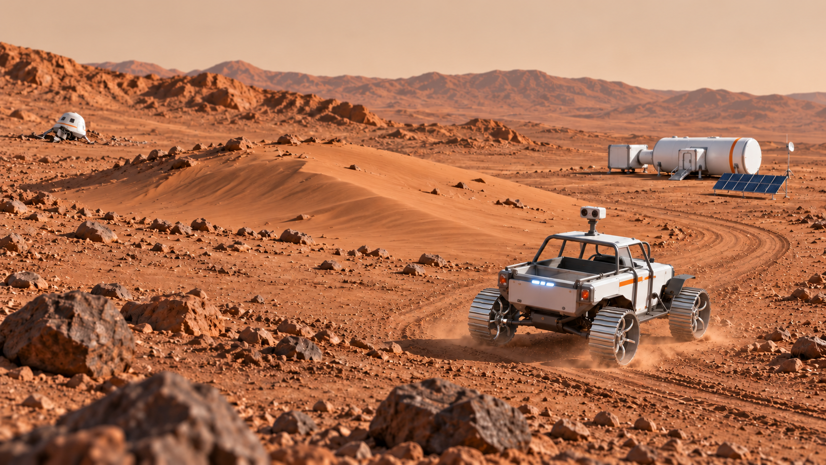
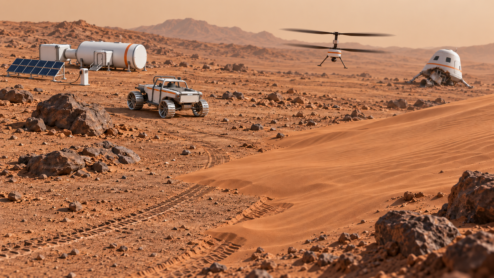
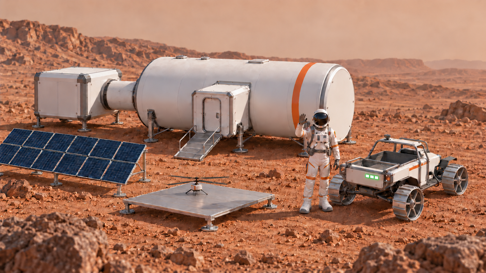
从求救出发,认识 AI,训练岩石/能源站分类模型。用两轮测试理解遗漏沙坡类别与驾驶规则为什么会造成失败。
手动无人机 → 自主探索 → 首轮地图。沙尘暴使信息可能失效,学生在同一游戏中再次迭代并验证更新地图。
沿用更新地图,完成手动/自主营救、动态小地图与充电安排。最后 30 分钟解释设计与演示。
| 学习线 | 孩子真正要学会 | 教师可观察的证据 |
|---|---|---|
| AI 与计算 | 区分模型分类、生成式 AI、规则与算法;知道结果需要测试。 | 能用自己的话说出“模型预测 → 行动规则 → 游戏后果”。 |
| 设计与证据 | 提出问题、比较方案、做决定、测试与修改。 | design HTML 有选择理由、研究来源、失败案例与改前改后比较。 |
| 合作与表达 | 轮流操作,听取他人理由,解释自己的贡献。 | 每位学生至少操作一次、提出一个决定、解释一次测试。 |
| 成果 | 最低要求 | 保留方式 |
|---|---|---|
| 模型记录 | 岩石/能源站两类基线、补充沙坡类别与行为规则、独立测试与改进比较。 | 样本来源、结果表、截图与模型保存位置。 |
| 无人机项目 | 手动与自主模式;地图 v1 与经过复核的 v2。 | 项目文件、可重新打开的地图、差异与验证说明。 |
| Rover 项目 | 手动/自主、碰撞、能量与充电、小地图位置、营救成功。 | 可运行项目、演示备份、已知限制。 |
| design HTML | 研究、方案理由、实现规则、测试与修改、跨天交接。 | 每组本地文件与课后备份;每位学生能解释一个决定。 |
把准备分成可验证的动作;“已经准备”应当意味着有人实际试过。
用实际账号,完整测试视频、Kahoot、训练、游戏与保存。
检查加入流程、窗口切换、音量、下载与重新打开。
断网或工具失效时,仍能继续分类、纸图探索和失败分析。
| 节点 | 要做什么 | 完成标志 |
|---|---|---|
| 开课前 1–2 周 | 确认年龄、设备、账号路径;选模型工具与游戏环境;准备家长说明。 | 用计划使用的设备与账号完成最小训练和地图交接。 |
| 开课前 3–5 天 | 试讲 AI 概念与失败讨论;验证七段通信与 design HTML;准备备用项目。 | 一位未参与开发的老师能按手册完成任务并找到备份。 |
| 前一天 | 模拟断网、误判、代码失效、地图导出失败;预备分组与角色。 | 每个故障都能在 3–5 分钟内切到可继续的教学活动。 |
| 提前 30–45 分钟到场 | 投影、音频、网页、游戏、文件目录、Kahoot 与充电检查。 | 从孩子座位看清文字,听清对白,能打开一条任务和本地视频。 |
| 每天结束后 | 导出成果、核对下一天恢复、记录困难与实际用时。 | 所有小组有可恢复的交付包,教师知道下一天先补哪里。 |
Google 官方区分学校账号的管理员启用、功能与数据处理方式,功能条件会变化。备课时检查 Gemini 学校账号说明 与 登录条件。Kahoot 参与者通常可通过 PIN 或链接加入,无需新建账号;以主讲设置为准,见 官方加入指南。
每一步都有教学目的、教师话术、学生动作、观察点和备用方式。
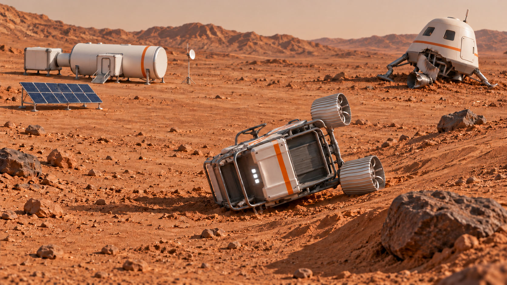
按现有课程年龄范围提供三套完整安排,每天 180 分钟。年龄是起点:首次操作、阅读和编程经验也决定支持程度。混龄班以共同任务开场,按实际需要分配基础与挑战,避免按年龄固定岗位。
组织与支持:优先 2 人合作。教师演示账号、文件和工具切换;孩子轮流做短操作,用口述、画图或选图留下决定,教师帮助填写 design HTML。不要要求孩子独立管理账号或调试长代码。
最低成果:能分辨岩石、能源站与沙坡;能指出一次失败,完成一次有理由的修改;能按更新地图安排充电,并解释一个决定。
提前完成:完成基本任务后,再让孩子选两个路线方案,指出哪个更安全;不以打字速度或代码长度加分。
当天准备:大幅物体图片、两类样本托盘、沙坡补充卡、教师已验证的训练入口与备用结果图、图标版 design HTML。
| 参考时间 | 活动 | 教师怎么带、学生怎么做 |
|---|---|---|
| 10 分钟 | 认识团队与角色 | 教师用操作/观察/记录图标解释轮换;孩子介绍一个兴趣,自己选第一轮岗位。 |
| 10 分钟 | 求救通信 01 | 播放后让孩子指着大图找基地、宇航员、岩石、沙坡和能源站;只问“哪些地方要小心?” |
| 15 分钟 | Kahoot 入门 | 逐题读题,先两人讨论再选择;不用抢答速度评价。孩子用“因为我看到……”解释。 |
| 20 分钟 | 一起做研究 | 教师展示预先核对的两条资料,演示一次 Gemini 提问;孩子选一条有用的信息,画或口述理由。 |
| 25 分钟 | 第一轮分类与训练 | 先在桌面按两类分图,再由教师带着小组点击训练;每个孩子亲自试一个未用于训练的例子。 |
| 10 分钟 | 休息与换角色 | 保存当前记录;短活动后重新分配操作员。 |
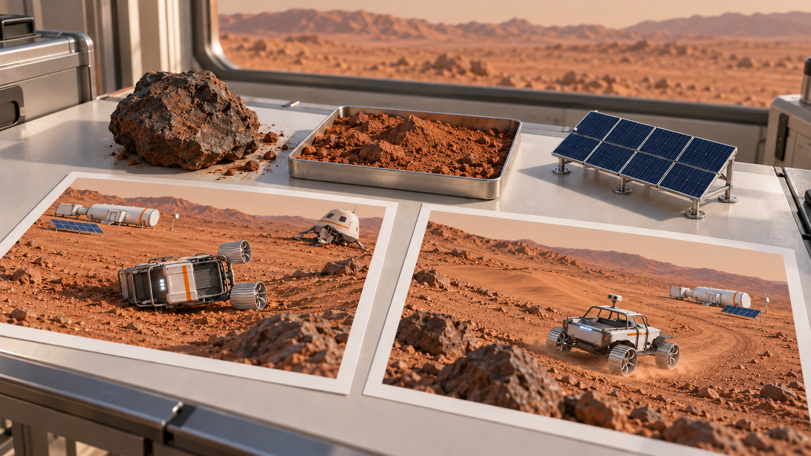
| 15 分钟 | 通信 02 · 看见失败 | 让孩子描述侧翻发生在哪里;摆出沙坡卡,问“我们的例子里面有没有这个?” |
| 35 分钟 | 补充沙坡并修改 | 拆成三段短操作:选新样本、加入沙坡类别、检查减速绕坡规则。孩子每段只作一个决定。 |
| 15 分钟 | 相同条件再测试 | 用同一份新例子表检查两轮。播放通信 03,分别指认减速与绕行;教师记录孩子真实结果。 |
| 15 分钟 | 收尾问答与表达 | 每人选一张失败/成功图,说“我改了……因为……”;完成 design HTML 的口述或图画证据。 |
| 10 分钟 | 通信 04 · 下一天 | 指认基地上仍未起飞的无人机;孩子复述明天是找地图,今天还没有完成营救。 |
“它刚才学过石头和能源站。这个沙坡没有在例子里。我们先补例子,再检查它碰到沙坡时怎么开。”
怎样判断学到了:教师逐人问:“哪一个例子原来没有?你们改了什么?”收集一张分类图、一条新例子测试记录和一句孩子自己的理由。
需要帮助时:不识字:读题、图标与口述;操作慢:教师代做文件操作,仍由孩子决定样本和规则;训练不可用:用对照结果图分析,并记录采用了示例。
当天准备:6 × 4 的练习纸图或教师预置小地图、箭头卡、已验证的逐行探索示例、v1/v2 保存文件夹。小地图尺寸一旦选定,两个游戏都用相同尺寸。
| 参考时间 | 活动 | 教师怎么带、学生怎么做 |
|---|---|---|
| 15 分钟 | 重播通信 04 | 指认无人机和今天目标;孩子打开上一天的设计记录。 |
| 20 分钟 | 看一遍研究示范 | 教师读两种探索方法:随意飞/按顺序飞;孩子用纸图比较容易漏掉哪里。 |
| 25 分钟 | 画小地图与按钮 | 孩子摆基地、宇航员、岩石、沙坡和能源站;教师记录统一坐标,孩子选方向键或大按钮。 |
| 30 分钟 | 轮流手动飞 | 每次只移动一格、揭开一格;观察员在纸图上同步标记。操作 10 分钟左右就换人。 |
| 25 分钟 | 运行逐行探索 | 教师展示向右→下一行→向左的箭头规则;孩子预测下一格,再运行示例检查有没有漏扫。 |
| 10 分钟 | 休息与保存 v1 | 让另一位组员重新打开地图,指出能源站。 |
| 30 分钟 | 通信 05 · 风暴与复核 | 只改一小片松沙,固定岩石和基地保留;用颜色区分待检查/已检查。孩子再飞一次并说出变化。 |
| 25 分钟 | 通信 06 · 保存与交接 | 保存地图 v2,孩子把它与 v1 对照。教师帮忙接入 Rover 示例,孩子提出哪里要充电;无人机仍是当天主任务。 |
“地图是我们看过的记录。风暴后这里还可信吗?再去看一遍,确认了才把新地图交给 Rover。”
怎样判断学到了:一个手动操作记录、一次逐行探索演示、一个明确的沙地变化与复核标记。孩子能指着同一位置解释 v1 和 v2 的区别。
需要帮助时:方向混淆:先在纸图做箭头游戏;算法困难:提供逐行示例,让孩子预测与检查;文件困难:教师协助命名,孩子负责指认变化。
当天准备:上一天的小地图 v2、教师可运行 Rover 骨架、醒目的能量格和充电点、每组一张展示顺序卡。
| 参考时间 | 活动 | 教师怎么带、学生怎么做 |
|---|---|---|
| 15 分钟 | 重播通信 06 与出发检查 | 孩子指出地图 v2 和能源站;教师提醒三格灯是游戏简化,不是现实充电计时。 |
| 30 分钟 | 手动试路线 | 孩子轮流短段驾驶;观察员说出当前位置、下一处危险和是否需要充电。 |
| 40 分钟 | 自动驾驶分段规则 | 教师一次示范一条:遇岩石绕行、遇松沙减速绕行、能量不足到站。孩子先排箭头再用 AI 帮实现。 |
| 25 分钟 | 核对右上角小地图 | 停在两个地标,孩子指出小地图上同一位置;不一致时由教师修坐标,孩子复查。 |
| 10 分钟 | 休息与保存可运行版本 | 重新打开一份备份,确认能继续。 |
| 30 分钟 | 测试、修一处、通信 07 | 让孩子先指出失败,再改变一个规则。确认游戏完成救援后播放成功通信,整理展示材料。 |
| 30 分钟 | 每组展示与提问 | 先让每个孩子口述一个决定,再展示手动/自主与充电;教师帮助操作文件,不替孩子解释。 |
“这条路短,可是电够吗?如果先去这里充电,能不能安全到达?我们跑一次,看看。”
怎样判断学到了:能指出两个地图位置、一处危险与一个充电决定;每位孩子至少有一次操作和一句自己的解释。
需要帮助时:时间紧:用教师骨架保留手动、地图与一条自主规则;自主尚未完成就如实展示已完成部分和下一步,不代说全部完成。
组织与支持:2–3 人合作,三个岗位轮换。教师只示范最小完整步骤,孩子负责样本、提示词、记录和游戏测试;账号与保存路径提前由教师跑通。
最低成果:完成两轮识别比较;完成手动/自主测绘和风暴后地图 v2;完成手动/自主营救、动态小地图、能量和充电;解释修改证据。
提前完成:尝试另一种探索或路线规则,用相同起点和条件比较覆盖、步数和能量;一次只增加一个变化。
当天准备:两类基线样本、独立测试集、补充沙坡样本、可保存模型的工具、design HTML 与 Gemini 提问示例。
| 参考时间 | 活动 | 教师怎么带、学生怎么做 |
|---|---|---|
| 10 分钟 | 介绍与轮换角色 | 学生介绍兴趣,确定第一轮操作/观察/记录,活动块结束后轮换。 |
| 10 分钟 | 通信 01 与任务拆解 | 学生复述营救为什么需要识别、地图与能量;教师不直接给方案。 |
| 15 分钟 | Kahoot AI 基础 | 每题抽一个理由,区分从数据学模式与按规则行动。 |
| 20 分钟 | Gemini 研究与核实 | 学生比较一个方案,打开资料核对一条事实,把自己的选择写进 design HTML。 |
| 25 分钟 | 训练模型 1 | 标注岩石/能源站;分开训练与新例子测试,记录至少一条误判。 |
| 10 分钟 | 休息与换岗 | 保存模型与测试表。 |
| 15 分钟 | 通信 02 · 失败分析 | 指出沙坡处失败,讨论类别遗漏和行动规则,提出可检验改进。 |
| 35 分钟 | 模型 2 与驾驶规则 | 补沙坡类,选不同角度和背景;保留基线,分别记录数据与代码规则改变。 |
| 15 分钟 | 同条件比较与通信 03 | 检查原两类表现与沙坡行为;不把影片成功当作本组模型证据。 |
| 15 分钟 | Kahoot 收尾与证据 | 每人解释一次修改及测试结果,填写限制。 |
| 10 分钟 | 通信 04 与次日交接 | 保存文件,明确无人机下一天才探索,不把图像当成已完成地图。 |
“模型给了哪个类别?真实情况是什么?即使分类对了,代码应该让车采取什么动作?”
怎样判断学到了:基线与改进模型记录、独立测试表、一次误判原因、数据与驾驶规则的分别说明。
需要帮助时:先检查样本标签、测试是否独立、代码映射是否正确;训练工具失效时采用对照模型并保留“教师示例”标记。
当天准备:12 × 8 课堂示例地图、坐标约定、地图 v1/v2 字段、可运行的移动骨架与保存文件夹。
| 参考时间 | 活动 | 教师怎么带、学生怎么做 |
|---|---|---|
| 15 分钟 | 重播通信 04 | 学生复述任务,恢复研究与设计记录。 |
| 20 分钟 | 研究探索规则 | 比较逐行与另一种方法,核实条件,把选择和理由写进模板。 |
| 25 分钟 | 设计地图与控制 | 统一左上原点、地图尺寸、固定地标和探索状态;先画草图。 |
| 30 分钟 | 实现手动测绘 | 先能移动,再揭开区域,再记录地形;每次增加一个功能并运行。 |
| 25 分钟 | 实现自主探索 | 让 AI 根据学生选择生成规则;用同一起点检查边界、重复访问与漏扫。 |
| 10 分钟 | 休息与保存 v1 | 另一位组员重新打开文件,检查字段与位置。 |
| 30 分钟 | 通信 05 · 地图再迭代 | 在原游戏修改受影响的松沙范围/通行状态,标待复核,重新探索与比较 v1/v2。 |
| 25 分钟 | 通信 06 · 交接与 Rover 起步 | 保存复核后的 v2,检查能源站。时间允许才开始 Rover 骨架;不挤占无人机复核。 |
“我们的算法什么时候算完成?风暴后哪几格信息需要更新?谁确认过新地图确实可以重新打开?”
怎样判断学到了:手动与自主运行记录、探索覆盖说明、v1/v2 变化和复核证据、完整可重新打开的地图文件。
需要帮助时:代码错误先复现一个最小步骤;坐标错先统一原点;保存错误先检查导出对象,不能只保存截图代替可读地图。
当天准备:地图 v2、Rover 项目、测试清单、展示计时与 design HTML 文件。
| 参考时间 | 活动 | 教师怎么带、学生怎么做 |
|---|---|---|
| 15 分钟 | 重播通信 06 与检查 | 确认地图版本、能源站、恢复路径与成功条件。 |
| 30 分钟 | 完成手动驾驶 | 连接碰撞、松沙规则和能量,测试接近能源站时是否能正确充电。 |
| 40 分钟 | 实现自主路线 | 先明确避障与充电规则,再让 AI 编码;用同一起点比较手动/自主结果。 |
| 25 分钟 | 动态小地图核对 | 在起点、能源站和中途点分别核对标记;两种驾驶模式都检查。 |
| 10 分钟 | 休息与备份 | 保存可运行版本及 design HTML。 |
| 30 分钟 | 独立测试与通信 07 | 测试不足电、障碍、沙坡、到站充电和成功条件,修一处关键问题并保留证据。 |
| 30 分钟 | demo 与设计解释 | 先打开设计记录,再演示游戏;每人讲一个决定和依据,回答一个追问。 |
“如果最短路到不了,为什么?我们如何让算法把充电点也当成路线的一部分?用哪次测试证明?”
怎样判断学到了:两种驾驶模式、实时小地图、至少一条能量或充电测试、一条失败→修改→再测试记录、每人设计解释。
需要帮助时:若基础未通过,优先修坐标、能量和成功判定。延后视觉装饰;按真实完成度演示,固定留下最后 30 分钟。
组织与支持:2–3 人合作,教师要求先写规格和测试再生成代码。角色包含实现、验证与记录,每个人都运行和解释;算法复杂度按已具备的编程能力调整,年龄不自动等于熟练。
最低成果:保留基线;用独立数据分项比较;输出可验证的地图 v2;实现手动/自主、同坐标小地图和能量约束;通过复现说明一次失败与修改。
提前完成:增加同条件算法比较、覆盖率/访问步数统计、能量感知寻路或模型低置信时的保守策略;先完成基本救援,再增加挑战。
当天准备:分好训练/测试的候选图片、标签表、按岩石/能源站/沙坡记录的测试表、版本命名规范。
| 参考时间 | 活动 | 教师怎么带、学生怎么做 |
|---|---|---|
| 10 分钟 | 团队与验证岗位 | 每位学生说兴趣与已有经验,安排轮换和谁负责复现。 |
| 10 分钟 | 通信 01 与任务约束 | 写下可观察成功条件与未知信息,暂不生成完整游戏。 |
| 15 分钟 | Kahoot 概念诊断 | 让学生指出训练、预测、规则和算法各在哪里;教师纠正混淆。 |
| 20 分钟 | 有来源的研究 | 比较两条方案的条件与限制;核对原始资料,在模板说明选择。 |
| 25 分钟 | 模型 1 与基线 | 记录类别覆盖与样本构成,锁定独立测试清单;保存逐例结果。 |
| 10 分钟 | 休息与版本保存 | 另一个组员复查标签和数据分离。 |
| 15 分钟 | 通信 02 · 拆解失败 | 提出类别遗漏/分布变化/行动规则等假设;区分影片设定与真实模型观测。 |
| 35 分钟 | 模型 2 与控制变量 | 补沙坡并分别记录样本和行为变化;尽量只改一个因素,再解释必须同时改变的因素。 |
| 15 分钟 | 分项评估与通信 03 | 按真实标签统计正确/错误,可画简易混淆表;检查是否牺牲了原两类表现。 |
| 15 分钟 | 证据与限制 | 回答“新背景下还可靠吗?”;记录未验证情况,明确置信分数的限制。 |
| 10 分钟 | 通信 04 与交接 | 归档模型、数据范围、测试结果和版本,复述测绘目标。 |
“这次改的是数据、类别还是行动规则?如果同时改了三处,我们如何知道是哪一处起作用?”
怎样判断学到了:逐例测试与分项结果、基线版本、控制变量说明、至少一个模型限制。能指出缺少的验证,而不是只说准确率变高。
需要帮助时:不熟编程者从规则表和表格统计开始;有经验者可增加混淆矩阵或保守阈值,但阈值须根据验证数据讨论,不任意称为安全保证。
当天准备:共享坐标规格、地图导出格式、逐行/DFS 或 BFS 的图解、版本差异表;无编程基础可只用逐行与规则改进。
| 参考时间 | 活动 | 教师怎么带、学生怎么做 |
|---|---|---|
| 15 分钟 | 通信 04 与恢复检查 | 确认项目入口、数据格式和地图版本字段。 |
| 20 分钟 | 研究与选择算法 | 讨论覆盖、访问次数与边界;选逐行或探索方法,说明适用条件。 |
| 25 分钟 | 规格先行 | 定义坐标、已探索/未知、地形与固定地标;写三个小地图测试用例再编码。 |
| 30 分钟 | 手动测绘基线 | 记录移动步数和已观察格数,核对地图坐标。 |
| 25 分钟 | 自主与同条件比较 | 实现所选方法;统计覆盖和重复访问,不能把随意自动移动当作完整探索。 |
| 10 分钟 | 休息与冻结 v1 | 保存代码和地图文件,不覆盖第一版。 |
| 30 分钟 | 通信 05 · 局部复核 | 只变动松沙信息,标记未知与待复核;设计针对受影响区域的重访,比较差异。 |
| 25 分钟 | 通信 06 · 数据交接 | 验证字段、边界和固定地标,生成 v2;给 Rover 项目写输入契约,再开始最小骨架。 |
“全覆盖是什么意思?当前保存的每个格子是观察到的还是猜的?风暴后重飞全图和只复核变化区各有什么代价?”
怎样判断学到了:可复现起点与完成条件、覆盖/访问记录、算法理由、v1/v2 差异、另一位组员验证的可读文件。
需要帮助时:DFS/BFS 是可选挑战,不强制。代码失败先在小地图复现;无时间做多算法时,深入解释并验证一种方法。
当天准备:地图 v2、位置与能量状态表、边界测试清单、可运行基线、demo 计时器。
| 参考时间 | 活动 | 教师怎么带、学生怎么做 |
|---|---|---|
| 15 分钟 | 通信 06 与输入契约 | 核对地图版本、坐标、充电规则、行动成本和成功条件;单位是游戏抽象。 |
| 30 分钟 | 手动基线与仪表 | 记录位置与能量变化,检查到站充电和耗尽行为。 |
| 40 分钟 | 自主规划 | 先实现可解释规则;有余力再比较 BFS/A* 或把能量加入状态。只求最短路径可能漏掉充电约束。 |
| 25 分钟 | 动态小地图与状态一致性 | 检查手动/自主两种模式,起终点、边界和站点位置一致;不另存一套漂移的坐标。 |
| 10 分钟 | 休息与冻结演示版本 | 保留可运行版本,再单独做试验,避免临场覆盖。 |
| 30 分钟 | 边界测试与通信 07 | 测试低能量、无路可达、沙地变更、到站充电和成功判定;写清至少一个失败如何复现与修复。 |
| 30 分钟 | 设计答辩与 demo | 按规格、选择、证据、结果、限制展示;每人回答一个问题,报告未完成或未验证部分。 |
“节点只存位置够不够?同一地点但电量不同,下一步可能不同吗?我们用哪个测试发现这个问题?”
怎样判断学到了:手动/自主基线、能量约束说明、边界测试、同条件方法比较或深入解释、明确的限制与下一步验证。
需要帮助时:不要因为年龄大就强推 A*。若进度紧,完成已验证规则和能量检查,比未经验证的复杂算法更符合学习目标。
下面 25 步提供通信、教学目的、观察问题与备选办法。先按上面选定年龄段的安排确定操作和评价要求,再查阅对应任务;不要把低年龄段的教师辅助误写成学生独立完成。
从求救片看清岩石、沙坡与能源站。先训练岩石/能源站两类模型,再通过漏训沙坡导致的侧翻理解类别遗漏;补充沙坡样本与驾驶规则,对照两轮测试。
老师和学生互相认识,介绍自己的兴趣与分工,进入三天 Workshop。
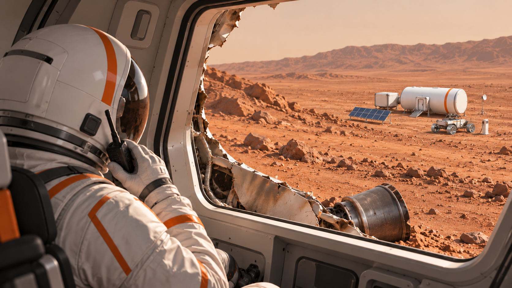
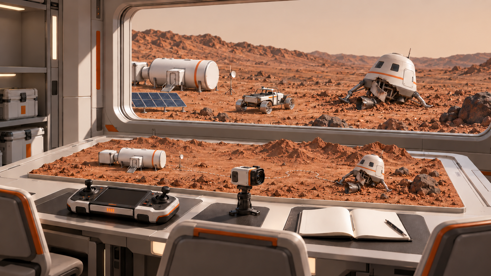
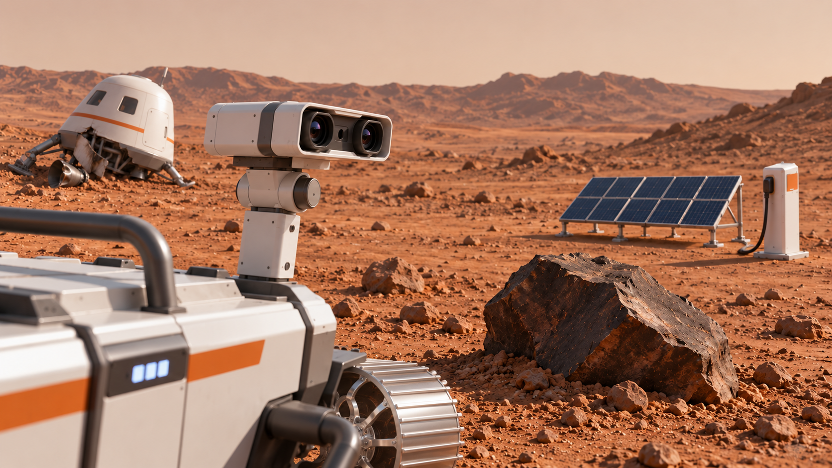
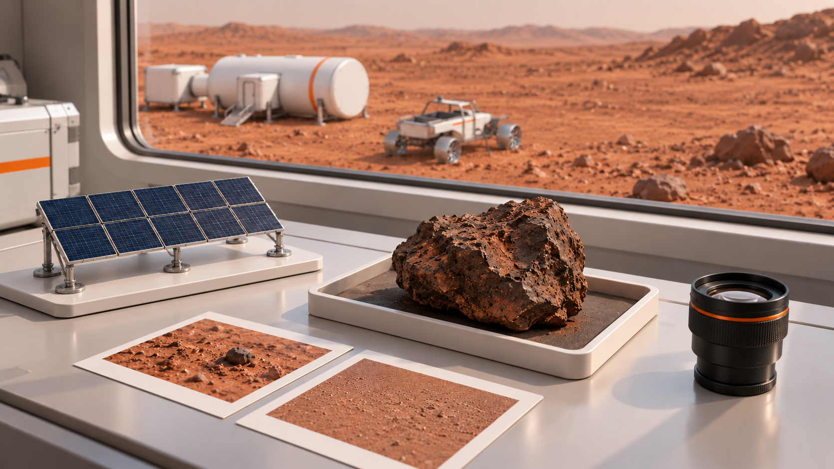
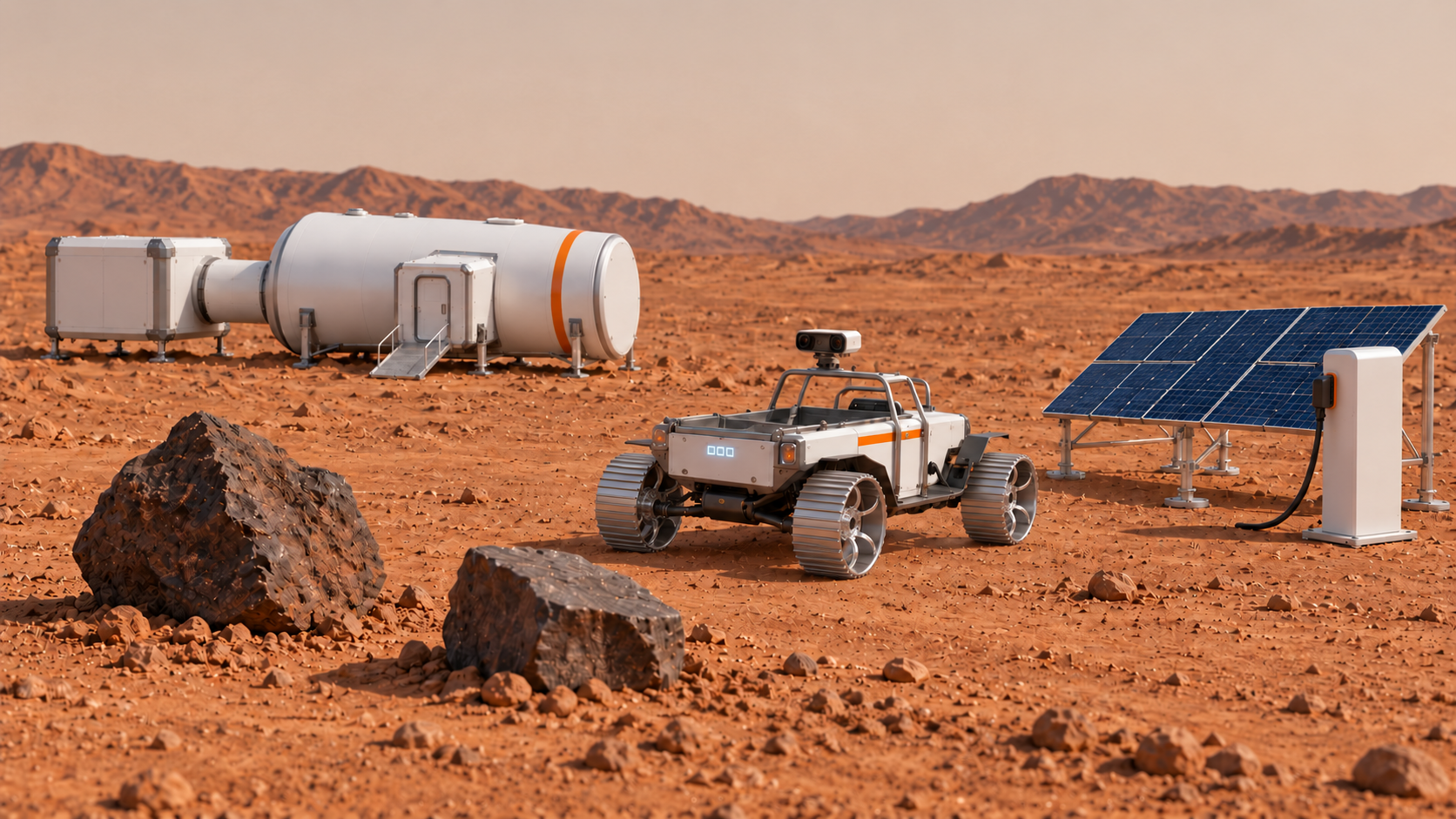
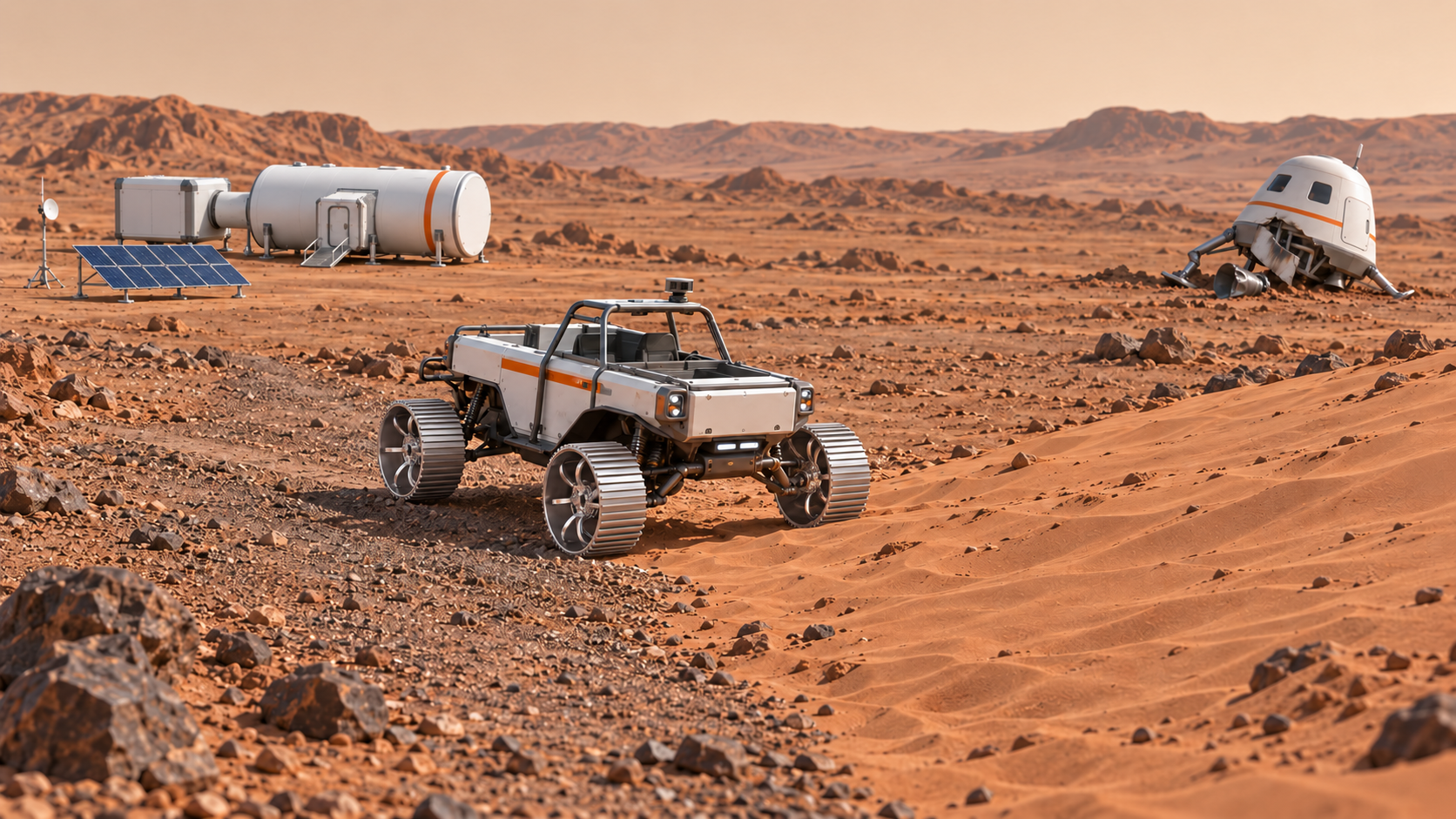
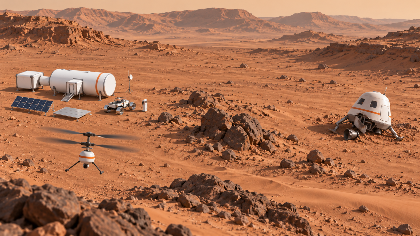
45 秒原片 + 两镜头各 4–6 秒:保留已确认的迫降原片,新增舱内越肩视角与同一区域俯瞰视角,让孩子看清基地、迫降区、岩石、沙坡与太阳能能源站的位置。
用提问、竞猜和讲解认识 AI、数据、模型与预测;理解 AI 会犯错,结果需要人来检查。
围绕“火星车怎样识别岩石与能源站”提问、比较和核实信息,按老师提供的 design HTML 模板记录研究与初步设计决定。
先用岩石与能源站样本训练模型 1,并用独立材料测试。保留结果,再观察面对未训练沙坡时的预测与行动规则限制。
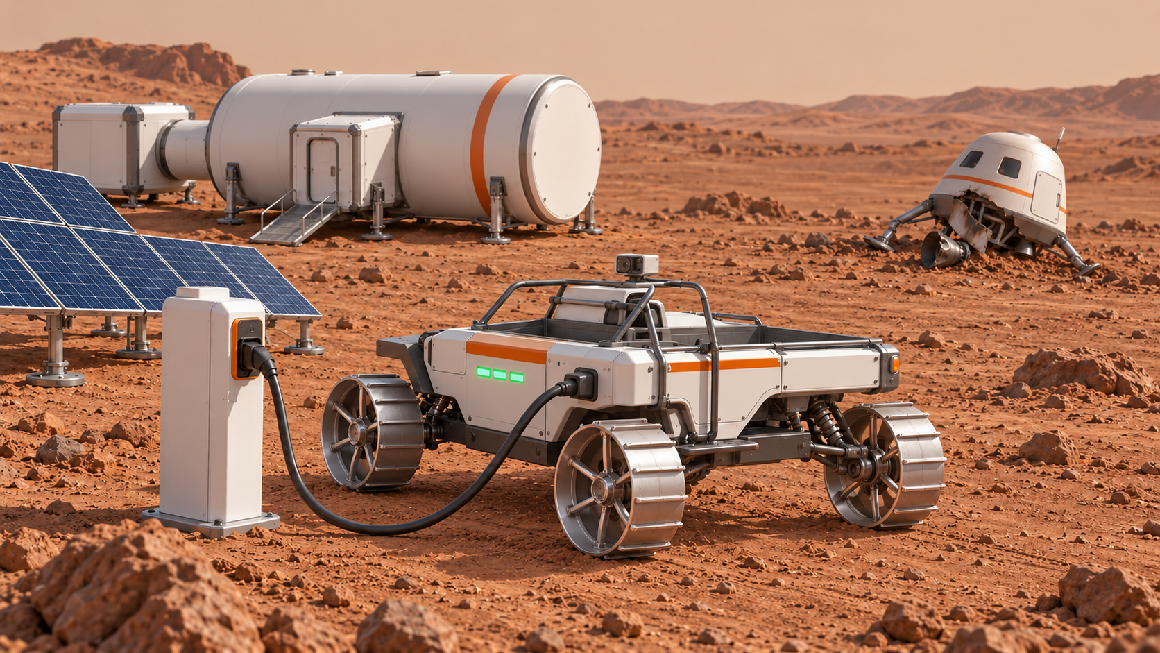
10–15 秒:Rover 已会避开岩石并到太阳能能源站充电,但未对沙坡减速或绕行;车轮打滑,轻轻侧翻。失败不是撞岩石或漏充电。
保留模型 1,新增沙坡类别与有代表性的样本,并明确减速、沿坚实地面绕行的规则。用相同测试材料和可比较的起始条件检查两版,记录变化与限制。
10–15 秒:保持失败片相同路线、机位、Rover 与起始能量;这次在沙坡前减速并走更坚实的地面,继续前进但还没有到达宇航员。
复习数据、训练、预测、测试与迭代。每位学生说出今天学到什么、哪次误判值得关注,以及做了什么修改。
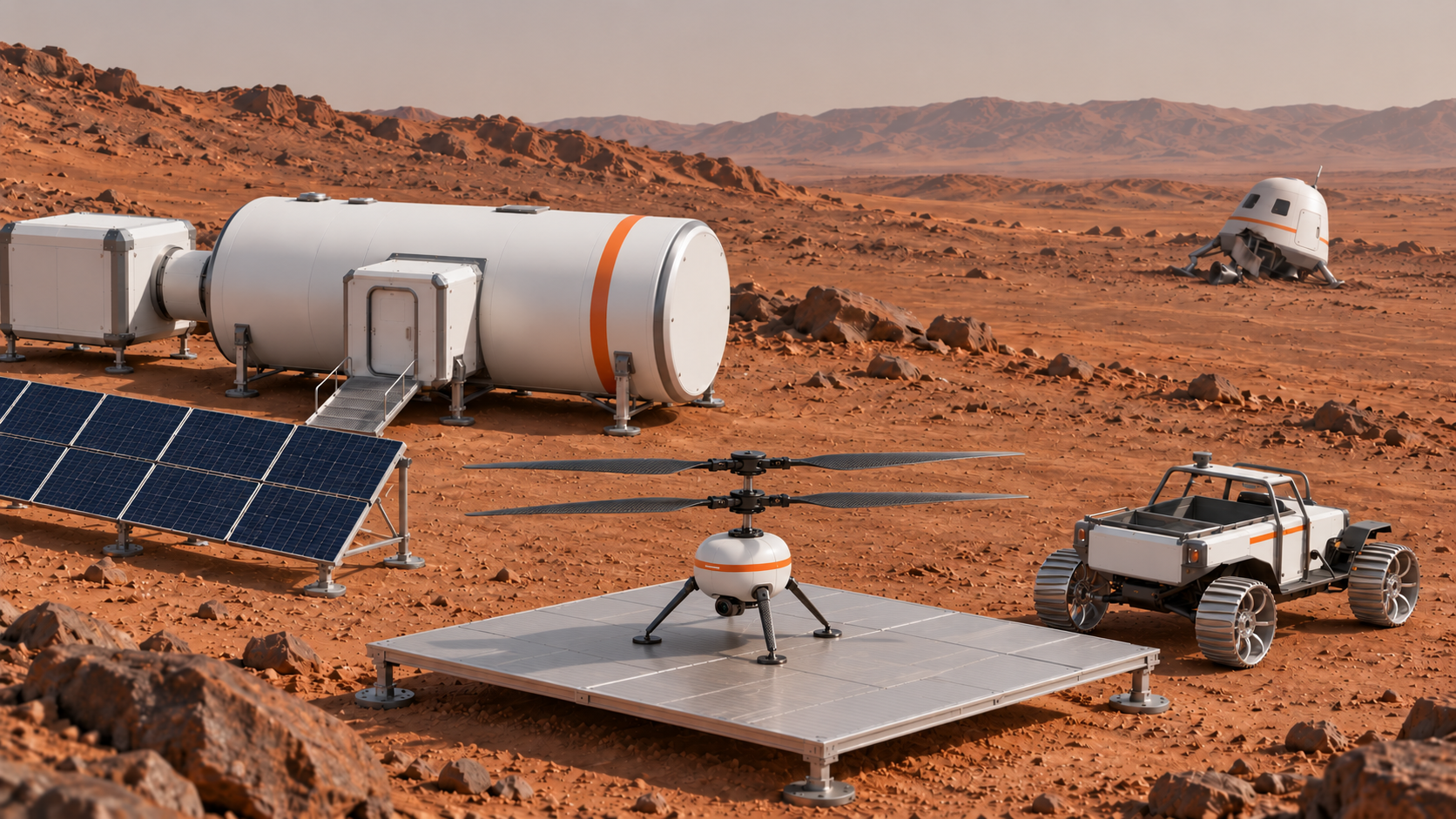
10–15 秒:复用模型 2 的成功行驶片段,宇航员通过头盔无线电讲话;末尾只展示在基地等待的小型无人机。
设计无人机测绘游戏:先手动探索,再让 AI 协助编写自主飞行算法。首轮地图完成后,沙尘暴触发一次新的迭代;复核并更新地图,作为第三天救援的依据。
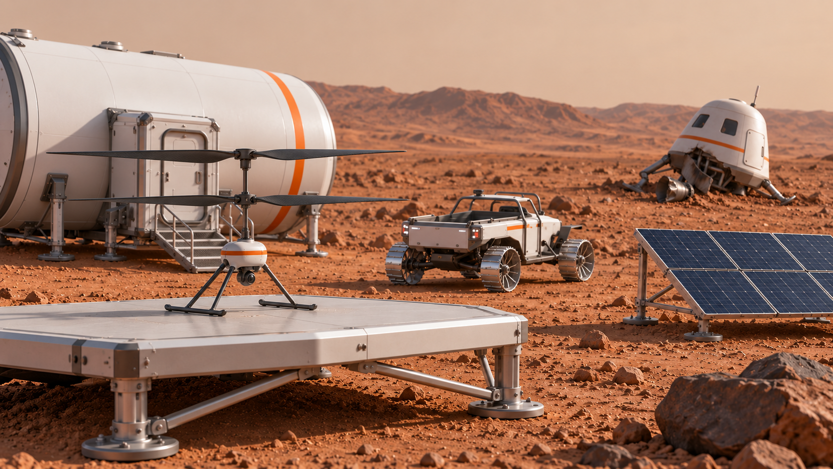
10–15 秒:复用模型 2 的成功行驶片段,宇航员通过头盔无线电讲话;末尾只展示在基地等待的小型无人机。
老师示范如何说明问题、限制和需要比较的方案。学生研究无人机控制、探索方式和地图表达,记录来源与判断。
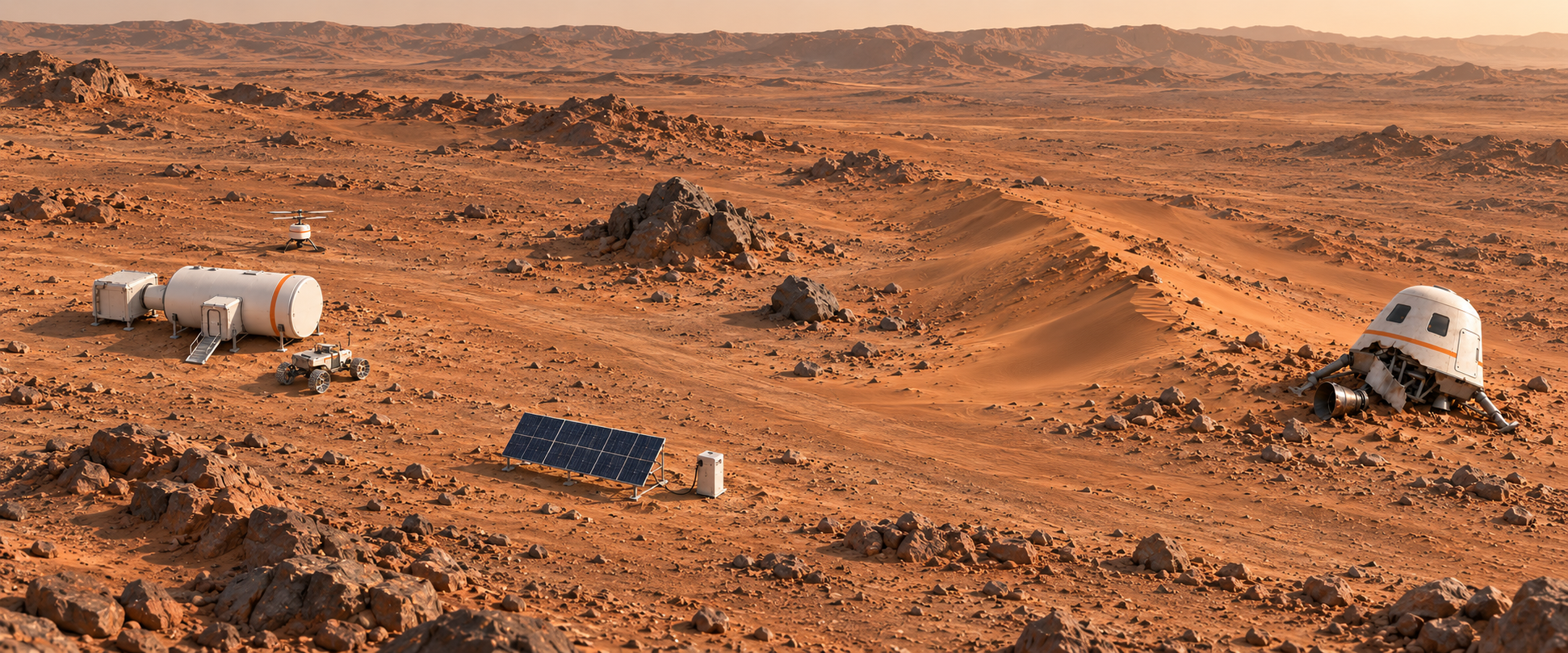
决定控制与探索规则,画清基地、受损飞行器、岩石、沙坡及太阳能能源站的位置,写到 design HTML。游戏地图与已确认原片保持相同地理关系。
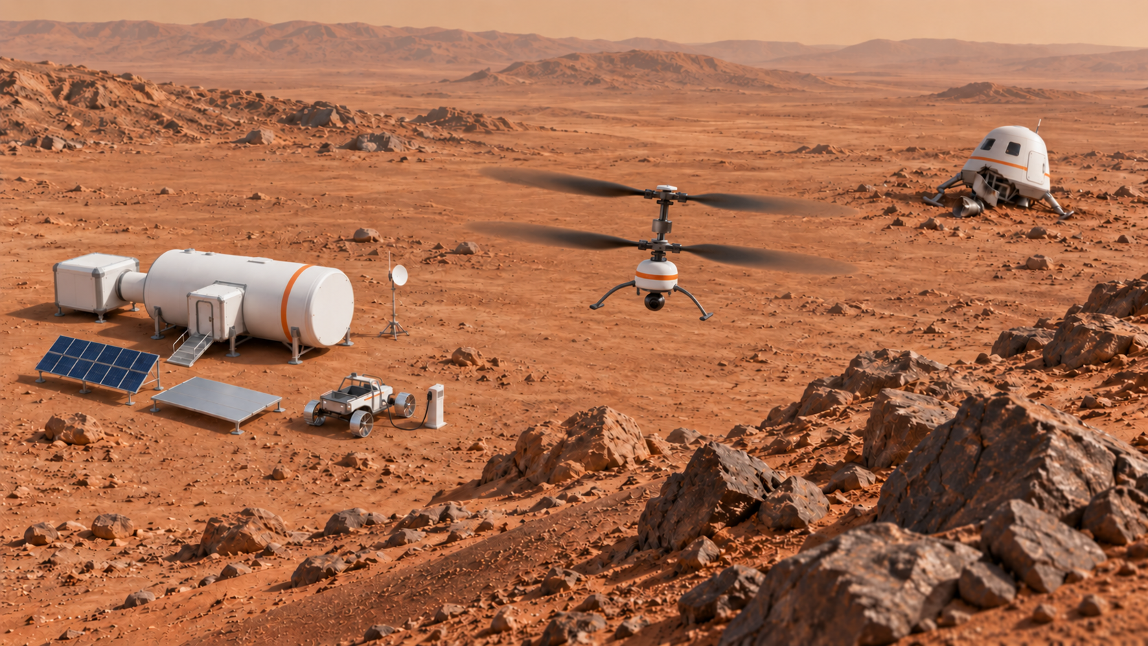
先手动探索并测试地图更新,再用 AI 按选定规则编写自主探索算法。比较覆盖范围、漏扫与重复经过的区域,完成首轮地图。
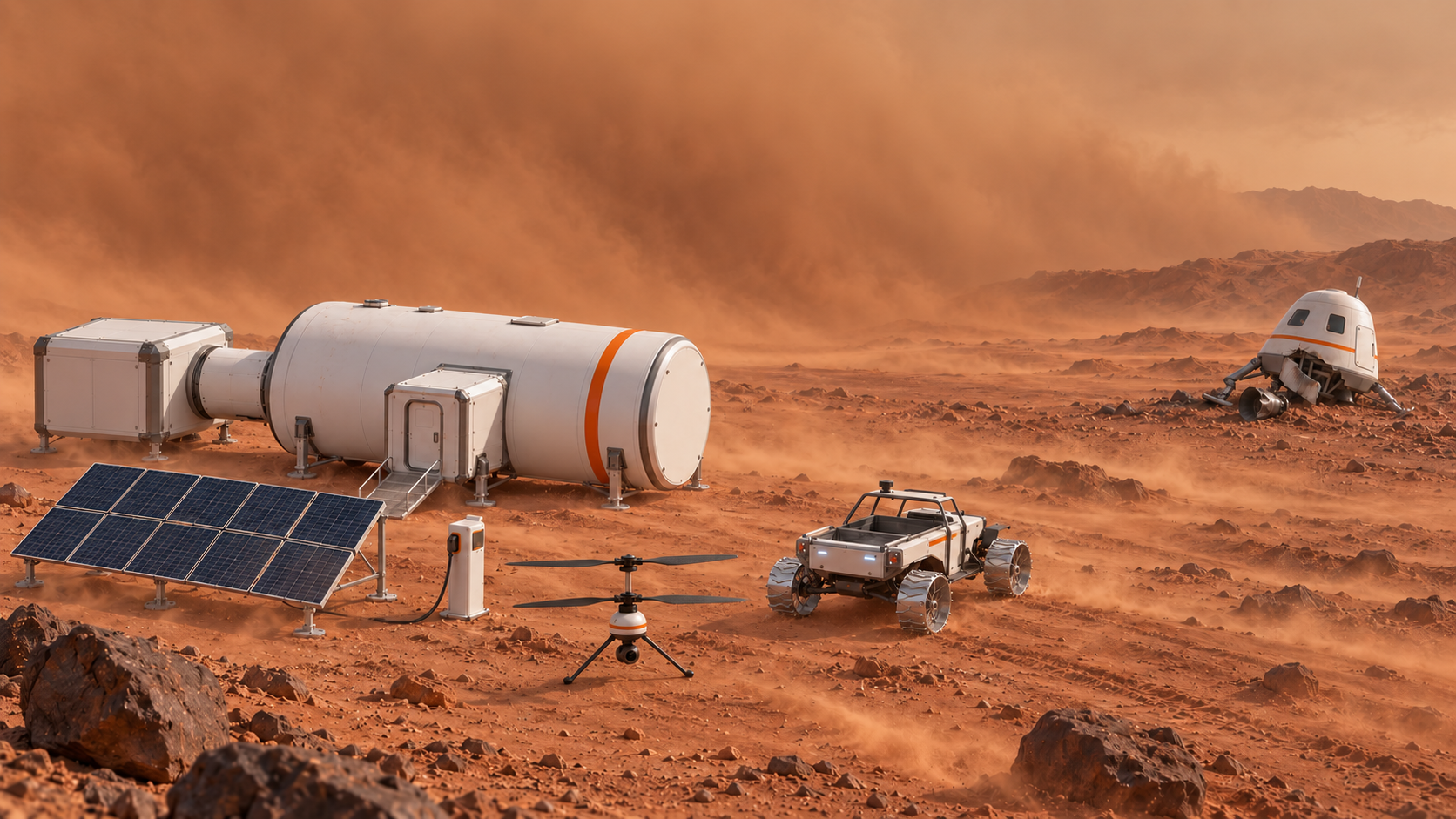
10–15 秒:风移动沙坡周围的松沙、部分覆盖已有车辙。风暴过后俯瞰能看出沙地路线变化,固定岩石、能源站与基地仍可辨认。
在同一个游戏中改变受风影响的松沙范围与可通行路线,而不是只换颜色。保留固定岩石、基地和能源站;重新飞行核实变化,验证并保存地图 v2。
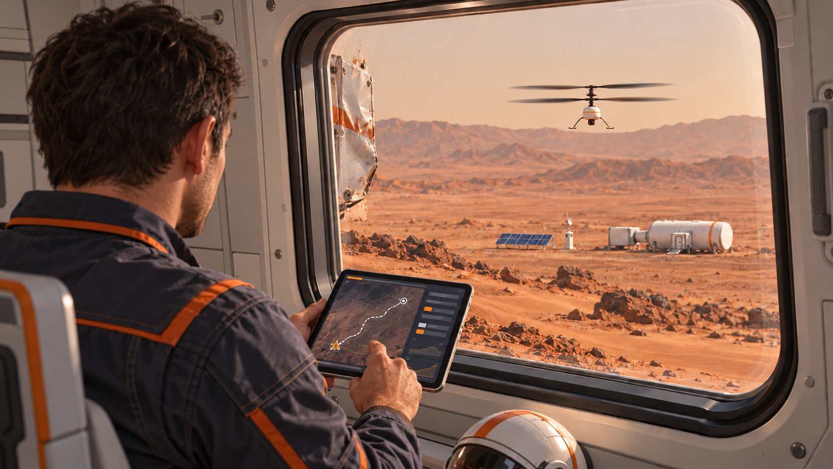
10–15 秒:重访开场的舱内窗景和俯瞰镜头,展示风暴后的更新地形。宇航员安全留在飞行器内,基地的 Rover 仍待出发,能量灯条可见。
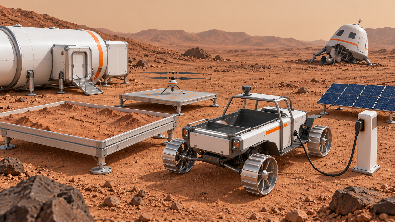
地图重制完成后,用 AI 开始搭建 Rover 游戏,接入更新地图,确定驾驶、能量与充电规则,第三天继续完成。
宇航员的补给只够再过一天。沿用风暴后更新地图,完成手动与自主驾驶、岩石与沙坡避让、充电和动态小地图;影片结尾展示宇航员安全回到基地。
10–15 秒:重访开场的舱内窗景和俯瞰镜头,展示风暴后的更新地形。宇航员安全留在飞行器内,基地的 Rover 仍待出发,能量灯条可见。
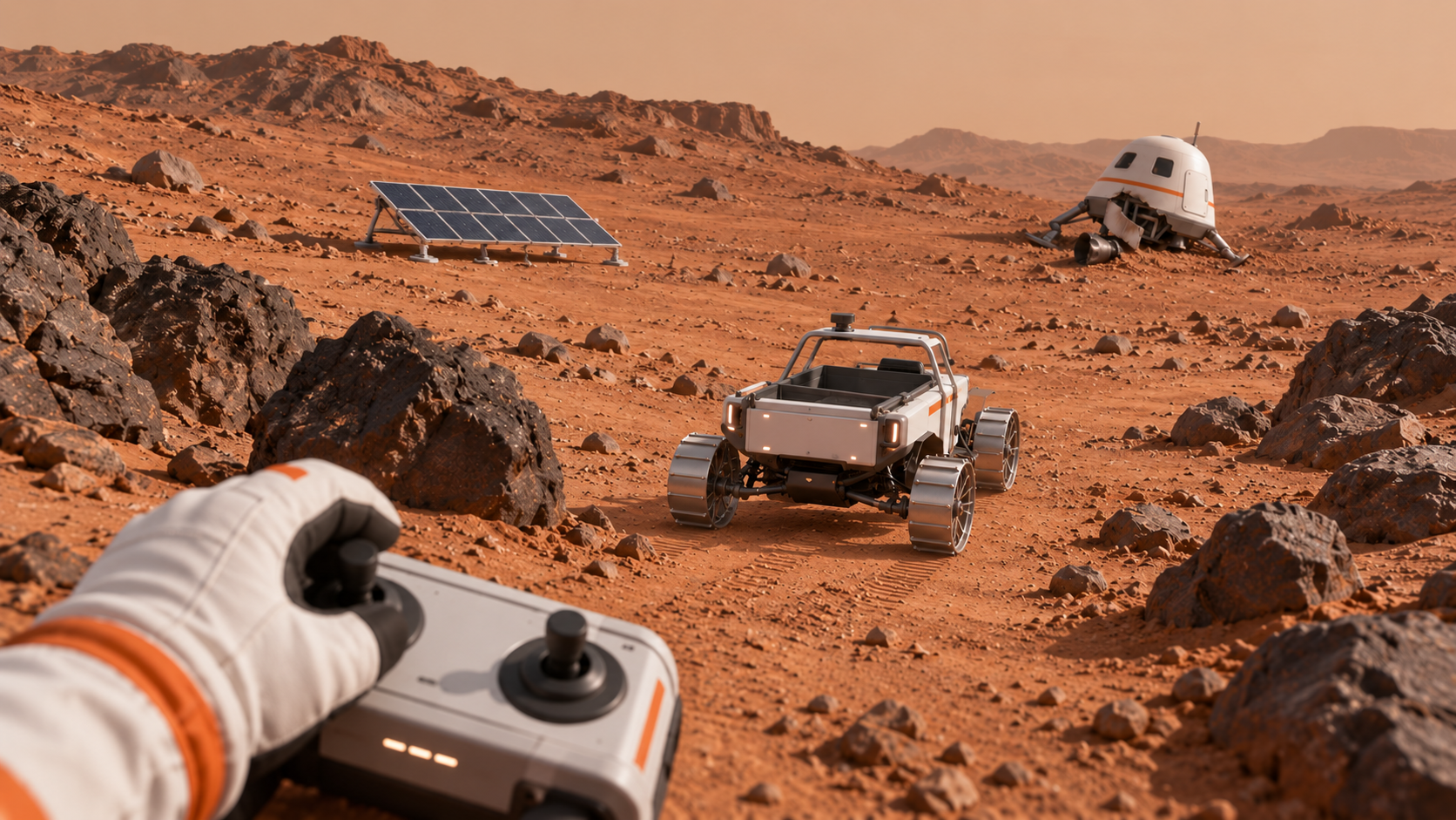
从基地出发,避岩石,面对沙坡减速并沿坚实地面绕行,途中补充能量,抵达宇航员。测试碰撞、打滑风险、能量与充电。
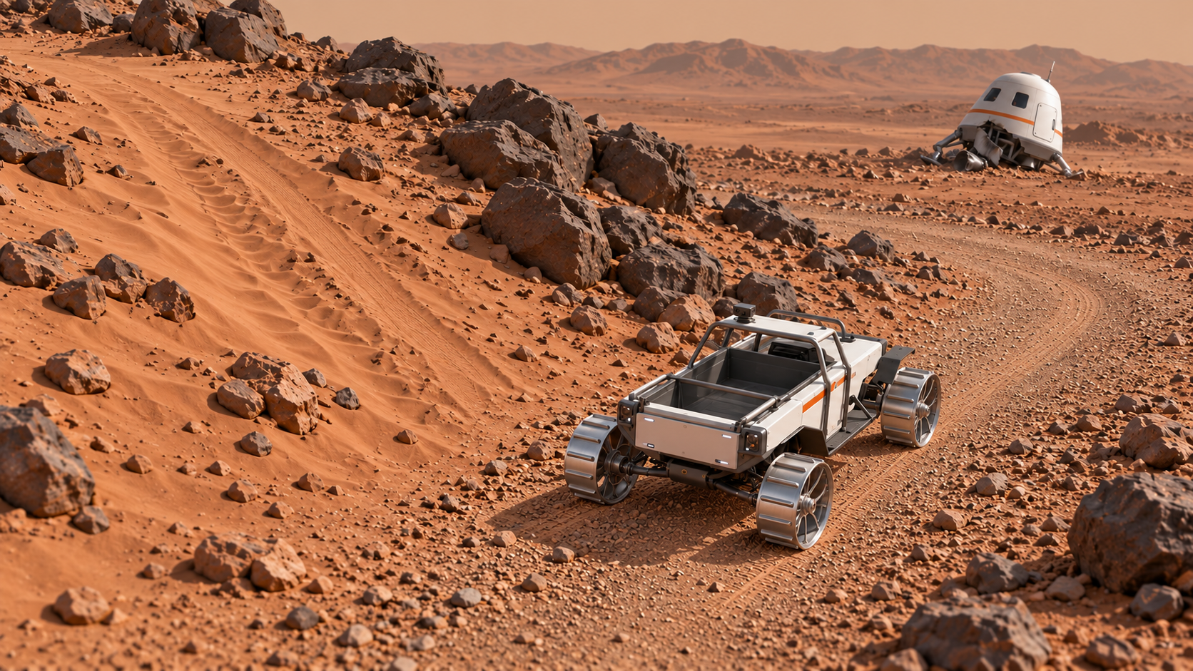
按更新地图、岩石与沙坡约束和充电需求选择路线规则,请 AI 实现自主驾驶。在同一地图测试并根据失败记录修改。
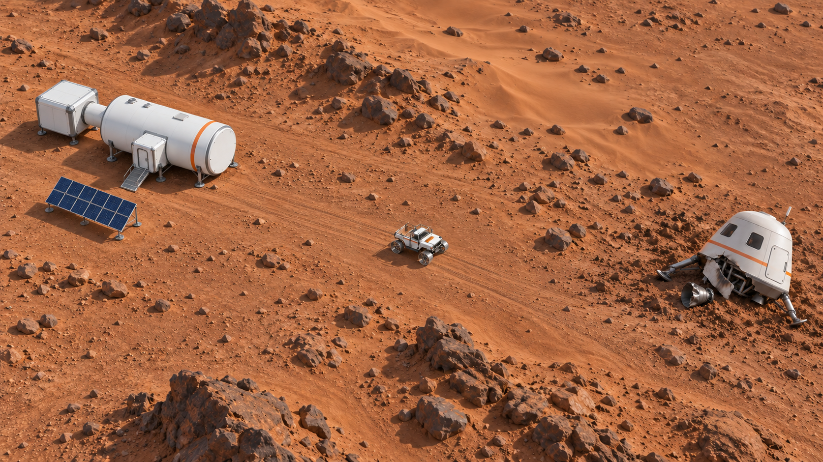
沿用第二天沙尘暴后重制并验证的地图,在右上角显示基地、宇航员与能源站等位置;随 Rover 移动,实时更新它的位置标记。
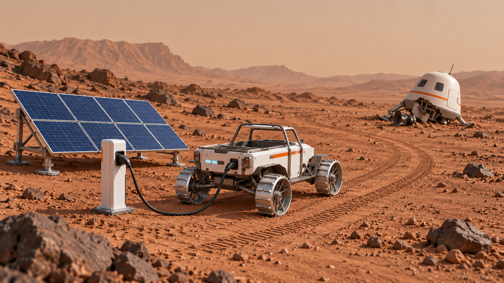
分别测试手动和自主营救,核对地图位置、碰撞与充电反馈。把失败案例、修改理由和最终选择整理进老师提供的 design HTML 模板,在展示前完成制作收尾。
10–15 秒:结尾直接展示宇航员安全返回既有基地,与同一辆救援 Rover 站在一起,向镜头温暖挥手并致谢。
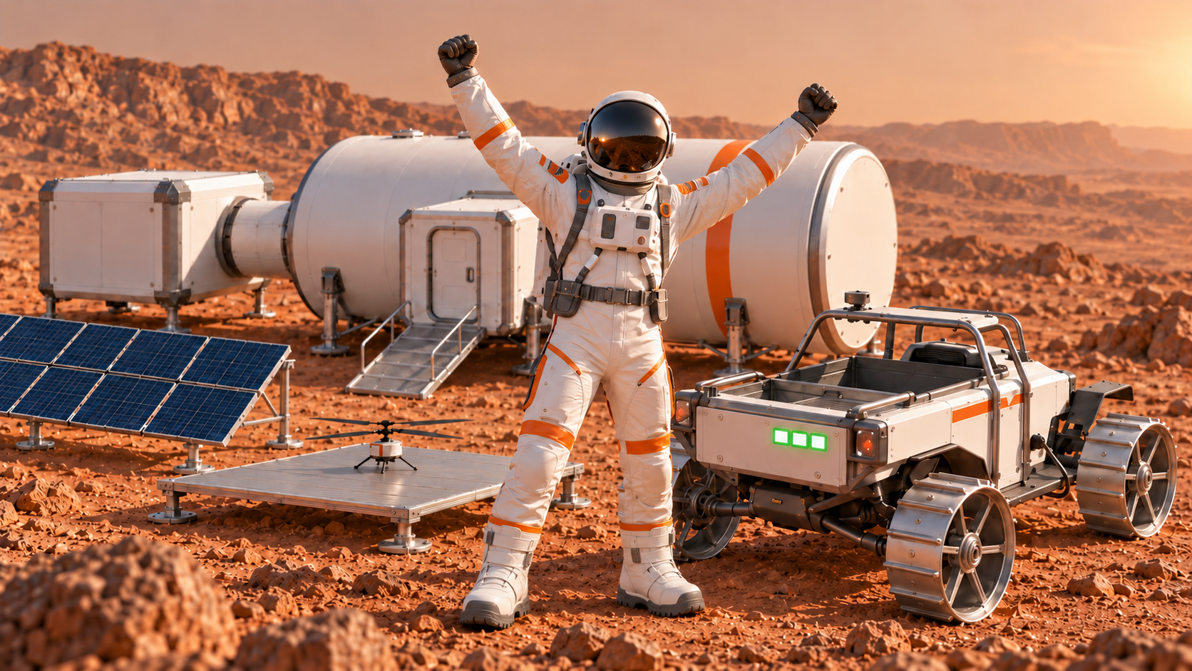
学生打开 design HTML 模板,讲解各处的 key decisions:选了什么、为什么、测试后改了什么。然后演示营救宇航员的游戏,展示两种驾驶方式和动态地图。
每个概念都有简单讲法、易错点和即时检查,不把术语一次性塞给孩子。
岩石/能源站 → 发现遗漏后补充沙坡。
从样本学习分类;没有覆盖的类别仍可能被错分。
预测类别和置信分数,需要与真实情况对照。
避岩石、减速绕坡、到能源站充电。
在相同测试条件下比较两轮结果,保存证据。
AI 是一类技术;这节课里的分类模型会根据训练例子预测类别。游戏规则决定预测后要做什么。
“认出岩石”和“转弯绕开”是两件事,像看见红灯和决定停车。
把 Gemini、分类器、自主路线算法都称为同一种模型训练。
给孩子一个正确类别但错误行动的例子,问应该改识别还是行动规则。
Gemini 可以生成解释、方案与代码;它给出的内容需要核实、运行和测试。
像一个会提出很多草稿的搭档,你仍要决定、检查和修改。
输出说得流畅就当成事实;复制代码就算学会设计。
让学生指出一条需要核实的信息和一个他们自己做的决定。
训练例子与类别名称一起提供给模型。标签要一致,样本要代表想识别的情形。
给一个新同学看多种岩石和能源站,并清楚说每张是什么。
样本越多就一定越好;混用 Rock、Stone、岩石导致类别混乱。
检查错标图、不同角度与背景;问模型有没有只学到背景颜色。
测试材料不参与训练,用来检查模型面对新例子时的表现。
只背练习题不能证明会做新题。
用训练图测试成功,当成模型可靠。
给一张新角度图片,记录预测、真实标签和是否误判。
置信度是模型对自身分类的输出分数,不等于真实正确率或保证。
很有把握也可能看错;看测试结果才能知道可靠到什么程度。
90% 分数理解成这次一定 90% 正确;低分时仍盲目行驶。
讨论不确定时游戏可以暂停、提示复核或请求人工确认。
样本环境太单一,模型可能在角度、背景或光照变化时表现变差。
只见过白纸背景上的岩石,来到沙地上可能认不出来。
为同一物体拍很多几乎相同的图,没有增加实际变化。
分别改变背景、光照或角度,比较哪种变化影响更明显。
发现问题 → 提出改进猜想 → 改一个重要因素 → 再测试 → 比较证据。
每次修一处,再看看是不是解决了原来的问题。
不断点击重新生成;一次改太多,成功后也不知道原因。
问“你这次改了什么?哪条记录说明有帮助?”
算法是可以执行的步骤与判断;自主模式按这些步骤运行,仍需验证。
先写“从左到右扫一行,再换到下一行”,再让电脑执行。
自动飞行等于聪明;自主路线只追求动画,不处理边界或结束。
孩子用语言解释步骤,另一个同学照着执行,看看哪里不明确。
地图探索要定义哪些格子已检查,哪些遗漏,什么时候算完成。
不是飞得远就好,要知道每一块该看的地方看过没有。
轨迹很长就算地图完成;重复经过很多次但角落仍没扫到。
检查已探索格数、待探索清单或固定测试点,不只看漂亮轨迹。
主游戏与小地图使用同一套位置关系,再按比例显示。
同一个格子,在大地图和小地图都应该指向同一个地点。
小地图是无关图片;位置标记靠视觉猜着移动。
停在基地、一个能源站、宇航员位置,逐点核对两视图。
沙尘暴情节表示某些信息需要复核;重新探索后才能确认更新地图可用。
昨天记下的路况,今天发生变化时要再检查。
只给地图换颜色就当作迭代;把沙尘暴理解成必须实现复杂物理模拟。
指认待复核区域,展示如何重新验证及 v1、v2 差异。
路线必须能通行,也必须在电量耗尽前补给;最短路径不必然是可行方案。
走得近但中途没电,也到不了。
电量条只做装饰;开到零仍可移动;充电可无限瞬间叠加。
运行一条直达耗尽路线、一条经过能源站路线,比较结果。
把输入、操作、期望、实际、结果写清;成功必须对应游戏约定的条件。
“看起来好了”不如“到指定位置、未碰撞、能量足够,并触发成功”。
点击终点即成功;动画一播就不再检查规则。
测试正常、失败与边界情况;说出成功条件具体是什么。
AI 可以帮助研究和实现;孩子负责提出目标、选择方案和解释证据。
让搭档写草稿,自己要读懂、试一试、说清为什么。
以是否由 AI 写代码判断学生是否学习;要求学生懂每一行才能展示。
让学生解释一个关键规则、一个改动和一个测试,而不是逐行背代码。
| 活动 | 输入与输出 | 应该怎样说 |
|---|---|---|
| 图像模型训练 | 带标签样本 → 预测类别与分数。 | “我们修改训练样本,并重新测试分类效果。” |
| Gemini research | 问题与背景 → 建议、解释与待核实资料。 | “我们比较了建议,并检查资料后做了选择。” |
| AI 协助写算法 | 地图与规则 → 可运行代码;需要实际测试。 | “我们提出规则,让 AI 帮忙实现,再根据运行结果修改。” |
两轮各选 5–6 题;题目之间保留讨论,别让积分替代理解。
答案:B · 预测会错,需通过证据与测试检查。
如果答案很有把握,但撞到了岩石,你相信什么证据?
答案:C · 本课分类器需要样本与标签。
两张外观不同的岩石为什么可以有同一个标签?
答案:B · 这两项活动目的与输入不同。
今天哪一步是真正的分类模型训练?
答案:C · 独立测试检查新例子。
你能给训练图准备一个不同角度的测试图吗?
答案:B · 识别与行动要连接,行为规则也需测试。
识别正确但仍撞上时,应该检查哪部分?
答案:B · 数据变化会影响泛化。
我们怎样准备更有代表性的例子?
答案:C · 学会已有两类不代表认识全部地形。分别补查类别、样本与驾驶规则,再对照测试。
你改了模型,还是改了行动规则?怎样证明?
答案:B · 分数不是可靠性保证,也不是电量或覆盖率。
高分错误时还要保留这条记录吗?为什么?
答案:C · 要检查区域覆盖,不以轨迹长度替代。
怎样知道还有哪里没看过?
答案:B · 复核要有重新探索与验证证据。
你会选择哪些区域优先检查?
答案:B · 可行路线同时受通行与能源约束。
你能设计一条更长但能补能的路线吗?
答案:C · 解释与证据让设计可评估。
从自己的项目挑出一条可讲的改进记录。
每次先明确自己的决定,再请求 AI 帮助;反馈要能复现。
例如:选择逐行探索;为何能减少漏扫。
地图大小、坐标起点、已有代码与禁止改变的部分。
先能移动,再更新探索状态,最后增加自主规则。
期望、实际、发生位置、复现步骤和测试记录。
我们在设计火星救援项目。年龄范围:【填写】。今天的问题是:【一个具体问题】。
已知条件:【基地、宇航员、岩石、能源站、地图大小与时间限制】。
请解释相关概念,比较两种可行方案和限制。给出可以打开核实的资料来源,说明不确定的地方。
先列出需要我们决定的问题,不要直接替我们定全部方案,也不要生成整套代码。
模型 1 先识别“岩石”和“能源站”,但我们遗漏了沙坡训练与避让规则。请帮助检查补充沙坡类别的样本计划。
训练样本:【数量、背景、角度、光照】。独立测试:【岩石、能源站、沙坡的新例子】。
实际预测:【真实标签、预测、分数】;驾驶规则:【减速、沿坚实地面绕行】。
分别说明标签/样本修改和驾驶规则修改;对比相同测试材料,并检查已知两类表现是否保留。不保证一定成功,不把 Gemini 对话当成真实模型训练。
请按下面已由我们决定的规则实现一个可运行的无人机测绘游戏。
地图:【行列、坐标起点】;标记:【基地、宇航员、岩石、沙坡、太阳能能源站】。
控制:【方向键或屏幕按键】;探索规则:【经过哪个范围算已探索】。
先只实现手动移动、边界、已探索标记与地图保存。暂不加入自主模式或复杂装饰。
请说明怎样运行,并给出三个必须由我们操作的测试。
现有手动无人机游戏已经能运行。请在这个版本上增加自主探索,不要重建不同地图。
算法规则:【例如逐行扫描/按探索点】;边界:【填写】;停止条件:【填写】。
保持已有手动模式、坐标和保存结构。
加入开始、暂停或停止,并记录覆盖与漏扫。解释算法步骤,列出需要测试的边界情况。
首轮地图已完成,沙尘暴使沙坡周围松沙与可通行路线发生变化。受影响区域:【填写】;变化前后沙地与通行状态:【填写】。
在现有无人机游戏中修改这些区域,再加待复核与重新扫描规则;不能只改变颜色。
固定岩石、太阳能能源站、基地与飞行器保持原位,保持坐标和手动/自主模式。不需要复杂物理模拟。
保留地图 v1 和验证后的 v2,检查每个变化区域及新的可行路线。先解释最小修改与验证,再提供代码。
无人机地图要交给 Rover 游戏。数据结构:【粘贴不含个人信息的示例】。
请检查地图尺寸、坐标起点、基地、宇航员、岩石、沙坡、能源站、版本及复核状态是否一致。
列出会导致错位、遗漏或无法读取的问题。不要另造不相关地图。
给出一个用三个固定位置核对主画面与小地图的测试步骤。
使用这份已验证的地图 v2:【数据或约定】。
手动控制:【填写】;碰撞规则:【填写】;初始能量:【数值】;移动消耗:【规则】;充电:【位置与规则】。
成功条件:【抵达宇航员且满足能量/碰撞条件】。
先实现可运行的手动版本,并保留地图右上角位置显示。列出正常路线、撞击、耗尽、充电、到达的测试。
现有手动营救游戏可运行。请按我们选择的路线规则增加自主模式。
规则:【可通行格、岩石与沙坡绕行、何时选择能源站、停止条件】。
保持相同地图、能量、碰撞和成功条件;不能直接传送到终点。
说明每一步如何决定,并给出会失败的测试案例与处理方式。
请修复一个具体问题,不改动已验证的其他功能。
期望:【应该怎样】;实际:【发生什么】;复现步骤:【1、2、3】。
相关代码或报错:【填写】;刚刚改动:【填写】。
先解释可能原因,再给最小修改,最后给验证原问题已解决、且没有破坏旧功能的测试。
这是我们的研究、选择、失败与修改记录:【填写】。
请帮助整理为 2 分钟讲述提纲:问题、选择理由、一次失败、一次修改、测试证据、当前限制。
不编造没有发生的研究、个人贡献或成功结果。保留我们自己的话,并给出可能被问到的三个问题。
设计记录要能接起三天,地图和规则也要能真正传递。
产出地形、站点、复核状态和坐标。
12 × 8;左上为 (0,0);保存相同坐标与版本。
驾驶规则和位置标记都读同一份数据。
| 记录栏 | 最低需要写什么 | 有用的例子 |
|---|---|---|
| 研究与来源 | 问题、核实过的来源、两种方案。 | 逐行扫描较容易检查覆盖,但要处理边界换行。 |
| 选择与理由 | 选了什么、比较过什么、为什么适合当前限制。 | 先用 12×8 网格,因为课时有限且位置容易对照。 |
| 实现规则 | 控制、判定、能量、成功与失败条件。 | 每移动一格耗 1 单位,能源站最多充到 20。 |
| 测试与修改 | 期望、实际、原因猜想、修改、重测结果。 | 右上角位置偏一格;修正坐标起点后核对三个点。 |
| 跨天交接 | 保存文件、地图版本、类别标签、坐标和已知限制。 | 第三天读取 map-v2;所有待复核区域已检查。 |
| 实施路线 | 适合什么情况 | 必须如实说明 |
|---|---|---|
| 路线 A:分别教学,再用标签规则衔接 | 首次试教、时间较紧、重点是分类训练与游戏设计。 | 训练结果用于理解类别与行动规则;后续游戏使用对象标签,不声称实时读取模型。 |
| 路线 B:把导出模型实际接入游戏 | 教师已经验证模型导出、加载、输入图像、预测与行动链。 | 展示一次实际预测如何改变 Rover 行为;准备加载失败和低置信度处理。 |
可选图像训练工具 Teachable Machine 提供收集样本、训练、测试和导出流程。是否采用它,应由教师在计划设备上验证;本课程不要求所有班级使用同一个训练工具。
| 字段或规则 | 约定 | 怎样核对 |
|---|---|---|
| 尺寸与坐标 | 列 x、行 y;左上角 (0,0),x 向右、y 向下。 | 基地和宇航员在两个项目中位置一致。 |
| 对象类型 | base、astronaut、rock、energy;名称和大小写固定。 | 能源站不被读取为岩石;未知类型给出提示。 |
| 版本与复核 | version=v2;受影响区域有已复核记录。 | 打开时显示当前版本,不能默默读取旧地图。 |
| 可通行区域 | 明确边界、岩石不可进入,规则一致。 | 无人机看到的障碍与 Rover 碰撞位置一致。 |
| 能源规则 | 初始能量、消耗、充电上限在两个模式中一致。 | 手动与自主经过同一个站得到相同效果。 |
| 小地图缩放 | 用相同坐标乘统一比例,并考虑偏移。 | 核对基地、能源站、宇航员三个固定点。 |
把合作、求助、切换和节奏写成可执行的规则,技术课堂才不会靠老师到处救火。
执行当前一步
说明自己做了什么
对照预期与实际
指出失败发生在哪
保存理由与证据
确认文件能重新打开
讲故事、示范概念、控制视频与任务切换、主持总结。每次转换先让学生停手,再说目标与完成标准。
处理设备、账号、代码与文件问题;先确认可复现现象,尽量让学生完成修改,不接管整个项目。
关注角色轮换、安静学生参与、常见误解、实际耗时。人手不足时由主讲在检查点做简短记录。
| 角色 | 职责 | 轮换时机 |
|---|---|---|
| 操作员 | 负责键盘与运行,先听完组内决定再操作。 | 完成一个任务或约 10–15 分钟后轮换。 |
| 观察/测试员 | 观察失败,读测试清单,指出期望与实际。 | 不能只等待;每轮至少提出一个测试。 |
| 设计记录员 | 在模板中记选择理由与改动证据。 | 记录员也要有操作机会;两人组可合并测试与记录。 |
暂停口令:“信号暂停。”学生停下键盘,保存当前状态,看投影。恢复口令:“继续任务。”每次示范控制在几分钟,马上让学生亲自试。
| 年龄段 | 教师支持 | 保持的共同目标 |
|---|---|---|
| 6–8 岁 | 教师协助 AI 操作与文字整理;用口述、图卡、截图解释;按键操作与对比结果由孩子参与。 | 能说出危险与补能、做一个选择、观察一个错误并参与修改。 |
| 9–11 岁 | 给问题句式与测试清单,轮值操作,鼓励比较两种方案。 | 记录研究、两种模式、迭代与设计理由。 |
| 12–15 岁 | 减少步骤支架,增加算法与测试条件比较,鼓励说明限制。 | 用证据解释取舍,而不是只增加代码量。 |
| 现象 | 教师回应 | 接下来的具体动作 |
|---|---|---|
| 一直调颜色和特效 | “这个效果能帮助哪个任务?” | 先证明控制、地图与测试可用,再留一小段视觉优化时间。 |
| 一人包办 | “下一个测试由另一位来跑,并解释结果。” | 交换操作员,原操作员只能口头建议。 |
| 反复让 AI 重写整个项目 | “先找最后一个可运行版本。这次只改一个问题。” | 写复现步骤,再发最小调试请求。 |
| 失败后气馁 | “我们已经知道一个不可靠的条件,这是一条有用信息。” | 选择最小可测试修改,及时让学生看到具体进展。 |
| 临近展示仍加功能 | “现在锁定版本。把限制写清,展示你们已有的证据。” | 保存、准备演示路径和一张备份截图。 |
下面是可修改的模板。先填实际安排与结果,再由教师通过正式渠道发送。
说明任务、工具、实际安排、准备物品和信息使用方式。
介绍学生做了什么选择、遇到什么困难、如何验证。
分享设计记录、运行证据和限制,不只展示漂亮成品。
家长您好:
我们将开展三天“火星救援 AI Workshop”。孩子们会在一个救援故事中学习 AI 基础,用 AI 工具辅助研究与代码实现,并设计无人机测绘和 Rover 营救游戏。
课程重点是提出问题、比较方案、测试失败、修改设计和解释理由。孩子不需要提前会编程;不同年龄会获得不同程度的操作与表达支持。
第一天训练与测试岩石/能源站识别;第二天进行手动和自主测绘,并在沙尘暴剧情后更新地图;第三天完成救援、能量规则和设计展示。
授课安排:【日期、每天时长、地点】。需要准备:【设备、充电器或其他已确认材料】。AI 账号与操作由教师按实际年龄和机构条件安排,具体方式为:【填写经实测确认的使用路径】。
最终成果以孩子能解释的研究、设计与测试记录为主。现场影像与作品公开展示安排将另行确认,未确认前不默认同意公开。
如孩子有需要教师了解的学习支持需求,请通过:【联系渠道】与我们沟通。
家长您好,今天我们完成了:【实际任务】。
孩子们重点学习了:【一到两个概念】。本组做出的一个设计决定是:【选择与理由】。遇到的问题是:【真实现象】,尝试的修改是:【修改】,测试发现:【结果或仍待改进处】。
今天保留的成果:【项目、地图、design HTML 或测试记录】。明天将继续:【下一步任务】。
您可以问孩子:“今天你们为什么这样设计?”“哪里失败过?”“你怎么知道修改有帮助?”这比只问游戏有没有做完,更能帮助孩子回顾学习。
家长您好,三天火星救援课程已经结束。
孩子们经历了识别模型的训练与测试、无人机手动/自主探索、沙尘暴后的地图复核,以及 Rover 的路线与能量设计。
本组最终完成:【真实完成范围】。目前仍有的限制:【具体限制,不编造成果】。孩子能够解释的设计决定包括:【一项选择】;一次有价值的修改是:【失败—修改—测试证据】。
AI 在研究与代码实现中提供帮助,孩子的学习体现在提出目标、比较建议、选择规则、操作测试和解释结果。
可带走的成果与访问方式:【已验证的文件或链接】。建议回家再让孩子演示一条成功路线和一个失败案例,并说明下一次会怎样改进。
感谢您的支持。我们会根据本次试教中的实际耗时、常见困难与学生反馈,继续改进课程。
不需要。教师会提供任务支架,AI 可以协助代码。我们看重孩子能否提出目标、做选择、测试与解释;不以独立写每一行代码作为所有年龄段的统一目标。
课堂要求先研究和设计,再建立小版本、亲自运行、找问题与修改。每组要在 design HTML 中保留理由和证据;教师会追问学生自己的决定。
分类模型、数据与标签、独立测试、误判、迭代,以及生成式 AI 对研究和代码的辅助作用。教师会明确区分这些活动。
不是。一次可解释的失败与改进有学习价值。教师会说明实际完成范围与限制,并观察是否有研究、选择与测试证据。
本课程准备岩石与能源站素材即可,不需要孩子脸部、家庭住址或私人对话。教师应先确认素材与工具的数据处理路径。
公开范围、身份信息和影像安排须单独确认;课程参加不自动等于同意公开。教师应按机构流程处理,先用小组代号整理成果。
由教师先实测账号类型、年龄条件、机构开关、容量和功能。家长说明只填写已确认的操作安排,不在准备未完成时承诺某项免费功能或要求临时购买。
请孩子用现有成果解释一条路线、一次误判和一次修改。若继续使用在线 AI 工具,按实际账号与监护安排进行;也可以只在本地查看记录和演示游戏。
| 避免这样说 | 可以这样说 |
|---|---|
| 三天就会掌握 AI/保证做出完整游戏 | 三天会经历研究、设计、测试与修改;最终范围依据实际班级进展。 |
| 这是孩子完全独立写的代码 | AI 协助实现,孩子参与了目标、规则、测试与修改;具体贡献见记录。 |
| 模型已经训练好,所以不会出错 | 在这些测试条件下结果有所改善,仍存在这些限制。 |
| 游戏没做完,所以效果不好 | 已完成哪些核心部分、遇到什么困难、留下什么改进证据。 |
评价设计思考、验证和合作,把华丽效果放在次要位置。
打开 design HTML,说明一个选择和理由。
展示手动/自主、动态地图和充电。
用测试记录解释一次失败和一次修改。
说清仍有的限制,以及下一步如何验证。
| 维度 | 起步表现 | 达到课程目标 | 进一步表现 |
|---|---|---|---|
| 研究与选择 | 能说出目标,依据较少。 | 比较过方案,有核实来源与选择理由。 | 能解释来源限制、条件变化与取舍。 |
| 测试与迭代 | 只展示结果,记录零散。 | 保留失败、具体修改和重测结果。 | 使用可比较条件,能解释仍未解决的问题。 |
| 地图与模式 | 一个模式可运行,地图衔接不稳。 | 手动/自主可演示,v2 地图与小地图位置一致。 | 能比较覆盖、路线与能源,并验证边界情况。 |
| 表达与合作 | 主要由一人讲或操作。 | 每人参与,并解释自己一个决定。 | 能回答同伴问题,清楚区分自己的贡献与 AI 帮助。 |
我今天负责了……我们选择……因为……一次失败是……我们修改……测试显示……如果再有时间,我会先检查……
先恢复学习活动,再修技术;备用方案应在开课前排练过。
用离线样本、纸质答案卡、教师读通信。
继续:分类与理由用已验证对照模型和测试截图分析。
继续:失败证据与修改退回可运行备份,缩小地图,一次修一个问题。
继续:规则与验证| 问题 | 先检查 | 继续教学的方式 | 避免 |
|---|---|---|---|
| Gemini 无法使用或达到限制 | 先确认网络、实际账号与机构开关。 | 投影教师预先核实的回答;学生继续比较与做决定,或用纸质方案卡。 | 不临时编造年龄、分发私人密码或无限等待。 |
| Kahoot 加入失败 | 确认当前 PIN、人数容量、学生网络。 | 答案卡/举牌,保留同样的理由讨论。 | 不把加入失败当作学生能力问题。 |
| 模型一直把两类混淆 | 看错标、背景、角度、样本代表性与测试独立性。 | 减少到一组清楚的材料,完成一次有目标的改进;用预备记录解释限制。 | 不只增加相同角度图片,也不反复点训练不看错误。 |
| 代码打不开或白屏 | 回到最近可运行版本,记录报错与复现动作。 | 先恢复手动移动与一张小地图,再逐项加功能。 | 不同时请求整套重写;保留旧版。 |
| 无人机自主飞但漏扫 | 检查边界、换行、访问标记、结束条件。 | 改成小网格逐行扫描,用覆盖清单验证。 | 不以轨迹长度或速度替代覆盖。 |
| 地图无法导出/读取错位 | 检查格式、版本、坐标起点和类型名称。 | 用示例地图结构核对三个固定点;必要时先人工复制小网格。 | 不换一张无关背景图冒充地图衔接。 |
| Rover 自主路线耗尽电量 | 检查消耗与站点规则,比较路线到下一站的需求。 | 先实现一条经过能源站的固定可行路径,再讨论更优算法。 | 不删除电量失败条件来制造成功。 |
| 时间不够 | 检查是否耗在装饰、重复请求或工具等待。 | 缩小地图,冻结核心功能;保留两种模式、一次迭代和设计证据。 | 不侵占最后 30 分钟,也不编造已完成的功能。 |
| 视频未完成/声音不工作 | 确认本地文件格式、音量与投影输出。 | 展示静帧与任务卡,由教师读已排练的台词。 | 不让媒体问题阻止知识和学生操作。 |
| 作品演示突然失败 | 确认项目文件、地图版本与操作步骤。 | 切到截图或短录屏,说明发生了什么、已知限制与下一步。 | 不由老师在现场代演成学生独立完成。 |
| 可用时间 | 优先保留 | 可以减少 |
|---|---|---|
| 每天约 180 分钟 | 完整三天链条、研究、两种模式、模型迭代、地图迭代、最后展示。 | 复杂美术、多个高级算法、大地图。 |
| 每天约 120 分钟 | 教师先提供可运行骨架,孩子选择规则并完成测试与迭代;第三天保留 30 分钟展示。 | 开放式从零搭建、过长 research、扩展题。 |
| 设备或操作基础不足 | 教师演示工具,小组纸面决策与共享设备测试;保留个人解释。 | 同时操作账号、复杂代码与多套界面。 |
第一次试教要收集信息,为下一轮改课留下理由。
哪些活动超时、谁需要帮助、错误发生在哪里。
孩子是否能解释决定?是否真正验证更新?
缩小范围、调整示范、改样本或留更多缓冲。
用同样的观察问题判断改动是否有效。
预测哪个概念最难、哪个工具最可能卡住、每段实际用时。写下希望验证的教学假设。
记录在哪一步需要全班暂停、哪些学生被包办、哪个提示改变了理解。用具体情境代替笼统好不好。
将问题按影响排序,只挑 1–3 项改动;保留原流程与变化原因,下次比较结果。
最新制作预期:45 秒迫降原片作为共同参考,开场插入两镜头,后续六片均为 10–15 秒。
新的写实母图 GEO-01 用于锁定场景位置。原 45 秒影片仍用于核对人物与设备身份;其实际地景与母图的衔接仍须逐镜检查。
测试路线默认关闭。开启后显示:基地 → 岩石区上方 → 折回左下太阳能站 → 松砂坡。这条线仅说明训练测试顺序,不是最终救援路线;最终营救路径需结合更新地图、地形风险与 Rover 剩余能量重新规划。
图片用途:下方旧任务插图保留动作与课堂讨论示例,不能再用于确定地标位置。后续侧翻、绕坡、风暴和救援镜头从本母图派生。
01 求救看清障碍02 失败漏训沙坡03 成功减速绕坡04 新任务无人机待命05 风暴旧图待复核06 最后一天提醒能量07 营救安全回基地GEO-01 is the authoritative landscape master reconstructed from the selected director map. Keep the base on the left, the solar charging station in the lower-left/middle, the rock zone centrally behind the station, the loose-sand slope farther right, and the damaged spacecraft at the far right. Preserve their ground positions, relative distances, scale, orientation, mountain skyline and light direction when moving the camera. The original 45-second film remains the identity and hardware reference; compare its landscape shots with GEO-01 before retaining them. Earlier story illustrations are not geographical references. Test order is base to rock zone, then back toward the lower-left charging station, then eastward in this image to the sand-slope approach. This is a test circuit, not the final rescue route. The later dust storm changes only loose sand and tracks, not fixed landmarks. Use the 45-second landing video as the visual reference for every new shot: the same astronaut, spacecraft, base, rover, solar power station, rocks, red sand, lighting, and cinematic style. Keep the geography consistent. Use no captions, signs, logos, or spoken words beyond the specified dialogue. The rover’s energy indicator should be a small, readable light gauge on its body, without numbers or text. Hardware and physical coherence correction: Keep the established white/orange rover body and mission geography, but use non-pneumatic aluminum drum wheels with raised metal traction ribs and slender titanium flexure spokes, not black rubber car tires. Keep motion slow and grounded. The mapping drone must have a tiny ultralight fuselage and two large-diameter counter-rotating carbon-fiber rotors, broadly inspired by Ingenuity; do not use a heavy consumer quadcopter. Depict subdued dusty Martian daylight. During storms, show dust obscuration and modest loose-sand changes, not wind overturning heavy spacecraft or vehicles. Fixed landmarks remain fixed. Charging is a time-compressed story action: the rover stops and connects to a solar-fed storage station; do not imply instant charging merely by proximity. Keep the astronaut safely in an intact pressurised cabin before rescue and in a sealed pressure suit outdoors. Story continuity: propulsion and exterior service equipment are damaged, while an independent emergency cabin retains breathable pressure. The astronaut cannot fly back. The suit has only enough independent life support remaining for a short transfer, not the long difficult walk to base; a rover pickup is required. The one-day limit refers to the cabin supplies in this fictional mission, not a universal spacesuit endurance. Immediately after landing a suit may still be worn; by the late-Day-2 cabin scene the astronaut wears light cabin coveralls and uses cabin radio. Outdoors always show a sealed EVA suit, with the same protective overboots enclosing the pressure-suit feet: padded lower-calf cuffs, a continuous covered junction to the suit legs, broad protected toes and substantial ribbed traction soles. No casual trainers, exposed socks or skin. Correct these material and flight-proportion issues consistently across new shots while preserving the specified dialogue and the reference film's other identity details.
保留已确认的迫降原片,新增舱内越肩视角与同一区域俯瞰视角,让孩子看清基地、迫降区、岩石、沙坡与太阳能能源站的位置。
延续原片已有的求救声。新增镜头不增加任务旁白或其他对白;课堂任务由教师在影片播放后说明。
GEO-01 is the authoritative landscape master reconstructed from the selected director map. Keep the base on the left, the solar charging station in the lower-left/middle, the rock zone centrally behind the station, the loose-sand slope farther right, and the damaged spacecraft at the far right. Preserve their ground positions, relative distances, scale, orientation, mountain skyline and light direction when moving the camera. The original 45-second film remains the identity and hardware reference; compare its landscape shots with GEO-01 before retaining them. Earlier story illustrations are not geographical references. Test order is base to rock zone, then back toward the lower-left charging station, then eastward in this image to the sand-slope approach. This is a test circuit, not the final rescue route. The later dust storm changes only loose sand and tracks, not fixed landmarks. Use the 45-second landing video as the visual reference for every new shot: the same astronaut, spacecraft, base, rover, solar power station, rocks, red sand, lighting, and cinematic style. Keep the geography consistent. Use no captions, signs, logos, or spoken words beyond the specified dialogue. The rover’s energy indicator should be a small, readable light gauge on its body, without numbers or text. Hardware and physical coherence correction: Keep the established white/orange rover body and mission geography, but use non-pneumatic aluminum drum wheels with raised metal traction ribs and slender titanium flexure spokes, not black rubber car tires. Keep motion slow and grounded. The mapping drone must have a tiny ultralight fuselage and two large-diameter counter-rotating carbon-fiber rotors, broadly inspired by Ingenuity; do not use a heavy consumer quadcopter. Depict subdued dusty Martian daylight. During storms, show dust obscuration and modest loose-sand changes, not wind overturning heavy spacecraft or vehicles. Fixed landmarks remain fixed. Charging is a time-compressed story action: the rover stops and connects to a solar-fed storage station; do not imply instant charging merely by proximity. Keep the astronaut safely in an intact pressurised cabin before rescue and in a sealed pressure suit outdoors. Story continuity: propulsion and exterior service equipment are damaged, while an independent emergency cabin retains breathable pressure. The astronaut cannot fly back. The suit has only enough independent life support remaining for a short transfer, not the long difficult walk to base; a rover pickup is required. The one-day limit refers to the cabin supplies in this fictional mission, not a universal spacesuit endurance. Immediately after landing a suit may still be worn; by the late-Day-2 cabin scene the astronaut wears light cabin coveralls and uses cabin radio. Outdoors always show a sealed EVA suit, with the same protective overboots enclosing the pressure-suit feet: padded lower-calf cuffs, a continuous covered junction to the suit legs, broad protected toes and substantial ribbed traction soles. No casual trainers, exposed socks or skin. Correct these material and flight-proportion issues consistently across new shots while preserving the specified dialogue and the reference film's other identity details. Two shots to insert into the opening video Scene 1 — Astronaut’s view, 4–6 seconds From inside the landed spacecraft, look past the astronaut’s shoulder through the window. The base is far away. Several large rocks, a sandy slope, and the solar power station are clearly visible between the crash site and the base. Dust from the landing continues to settle. Hold the view long enough for children to notice the obstacles while the existing plea for help continues. Scene 2 — Overhead view, 4–6 seconds Cut to a high, clear aerial view of the same landscape. Show the spacecraft at one end and the base at the other, with the rocks, sandy slope, and solar power station in their established positions. A single rescue rover is parked immediately outside the base. Move the camera slowly along the route; do not draw a route line or move the rover yet.
Rover 已会避开岩石并到太阳能能源站充电,但未对沙坡减速或绕行;车轮打滑,轻轻侧翻。失败不是撞岩石或漏充电。
无对白。用动作与车身无字灯条说明决策顺序;不出现字幕、识别框、标签、数字、警报文字或营救。
GEO-01 is the authoritative landscape master reconstructed from the selected director map. Keep the base on the left, the solar charging station in the lower-left/middle, the rock zone centrally behind the station, the loose-sand slope farther right, and the damaged spacecraft at the far right. Preserve their ground positions, relative distances, scale, orientation, mountain skyline and light direction when moving the camera. The original 45-second film remains the identity and hardware reference; compare its landscape shots with GEO-01 before retaining them. Earlier story illustrations are not geographical references. Test order is base to rock zone, then back toward the lower-left charging station, then eastward in this image to the sand-slope approach. This is a test circuit, not the final rescue route. The later dust storm changes only loose sand and tracks, not fixed landmarks.

Use the 45-second landing video as the visual reference for every new shot: the same astronaut, spacecraft, base, rover, solar power station, rocks, red sand, lighting, and cinematic style. Keep the geography consistent. Use no captions, signs, logos, or spoken words beyond the specified dialogue. The rover’s energy indicator should be a small, readable light gauge on its body, without numbers or text.
Hardware and physical coherence correction: Keep the established white/orange rover body and mission geography, but use non-pneumatic aluminum drum wheels with raised metal traction ribs and slender titanium flexure spokes, not black rubber car tires. Keep motion slow and grounded. The mapping drone must have a tiny ultralight fuselage and two large-diameter counter-rotating carbon-fiber rotors, broadly inspired by Ingenuity; do not use a heavy consumer quadcopter. Depict subdued dusty Martian daylight. During storms, show dust obscuration and modest loose-sand changes, not wind overturning heavy spacecraft or vehicles. Fixed landmarks remain fixed. Charging is a time-compressed story action: the rover stops and connects to a solar-fed storage station; do not imply instant charging merely by proximity. Keep the astronaut safely in an intact pressurised cabin before rescue and in a sealed pressure suit outdoors. Story continuity: propulsion and exterior service equipment are damaged, while an independent emergency cabin retains breathable pressure. The astronaut cannot fly back. The suit has only enough independent life support remaining for a short transfer, not the long difficult walk to base; a rover pickup is required. The one-day limit refers to the cabin supplies in this fictional mission, not a universal spacesuit endurance. Immediately after landing a suit may still be worn; by the late-Day-2 cabin scene the astronaut wears light cabin coveralls and uses cabin radio. Outdoors always show a sealed EVA suit, with the same protective overboots enclosing the pressure-suit feet: padded lower-calf cuffs, a continuous covered junction to the suit legs, broad protected toes and substantial ribbed traction soles. No casual trainers, exposed socks or skin. Correct these material and flight-proportion issues consistently across new shots while preserving the specified dialogue and the reference film's other identity details.

1. Missing sand-slope training — 10–15 seconds
The rescue rover leaves the base with a visible energy gauge. It identifies and drives around the rocks, then stops at the solar power station to recharge; its gauge rises. Continuing toward the spacecraft, it reaches the sandy slope without slowing or steering around it. Its wheels slip and it gently tips onto its side. Show a safe, nonviolent mishap with no damage or rescue. Make the sequence of decisions visually clear without labels or captions.
保持失败片相同路线、机位、Rover 与起始能量;这次在沙坡前减速并走更坚实的地面,继续前进但还没有到达宇航员。
无对白。完整保留岩石避让、能源站充电和能量灯条变化;不加成功字幕、识别标签或数字。
GEO-01 is the authoritative landscape master reconstructed from the selected director map. Keep the base on the left, the solar charging station in the lower-left/middle, the rock zone centrally behind the station, the loose-sand slope farther right, and the damaged spacecraft at the far right. Preserve their ground positions, relative distances, scale, orientation, mountain skyline and light direction when moving the camera. The original 45-second film remains the identity and hardware reference; compare its landscape shots with GEO-01 before retaining them. Earlier story illustrations are not geographical references. Test order is base to rock zone, then back toward the lower-left charging station, then eastward in this image to the sand-slope approach. This is a test circuit, not the final rescue route. The later dust storm changes only loose sand and tracks, not fixed landmarks.

Use the 45-second landing video as the visual reference for every new shot: the same astronaut, spacecraft, base, rover, solar power station, rocks, red sand, lighting, and cinematic style. Keep the geography consistent. Use no captions, signs, logos, or spoken words beyond the specified dialogue. The rover’s energy indicator should be a small, readable light gauge on its body, without numbers or text.
Hardware and physical coherence correction: Keep the established white/orange rover body and mission geography, but use non-pneumatic aluminum drum wheels with raised metal traction ribs and slender titanium flexure spokes, not black rubber car tires. Keep motion slow and grounded. The mapping drone must have a tiny ultralight fuselage and two large-diameter counter-rotating carbon-fiber rotors, broadly inspired by Ingenuity; do not use a heavy consumer quadcopter. Depict subdued dusty Martian daylight. During storms, show dust obscuration and modest loose-sand changes, not wind overturning heavy spacecraft or vehicles. Fixed landmarks remain fixed. Charging is a time-compressed story action: the rover stops and connects to a solar-fed storage station; do not imply instant charging merely by proximity. Keep the astronaut safely in an intact pressurised cabin before rescue and in a sealed pressure suit outdoors. Story continuity: propulsion and exterior service equipment are damaged, while an independent emergency cabin retains breathable pressure. The astronaut cannot fly back. The suit has only enough independent life support remaining for a short transfer, not the long difficult walk to base; a rover pickup is required. The one-day limit refers to the cabin supplies in this fictional mission, not a universal spacesuit endurance. Immediately after landing a suit may still be worn; by the late-Day-2 cabin scene the astronaut wears light cabin coveralls and uses cabin radio. Outdoors always show a sealed EVA suit, with the same protective overboots enclosing the pressure-suit feet: padded lower-calf cuffs, a continuous covered junction to the suit legs, broad protected toes and substantial ribbed traction soles. No casual trainers, exposed socks or skin. Correct these material and flight-proportion issues consistently across new shots while preserving the specified dialogue and the reference film's other identity details.

2. Successful training — 10–15 seconds
Repeat the route, camera angles, rover, and starting energy level from Video 1 so students can compare the outcomes. The rover again avoids the rocks and recharges at the power station. This time, as it approaches the sandy slope, it visibly slows, assesses the terrain, and carefully drives around it on firmer ground. It continues safely toward the spacecraft, but does not reach the astronaut yet.
复用模型 2 的成功行驶片段,宇航员通过头盔无线电讲话;末尾只展示在基地等待的小型无人机。
I'm glad to hear you have trained and tested the rover. Next you need to use a drone to map out the route for rescue.
GEO-01 is the authoritative landscape master reconstructed from the selected director map. Keep the base on the left, the solar charging station in the lower-left/middle, the rock zone centrally behind the station, the loose-sand slope farther right, and the damaged spacecraft at the far right. Preserve their ground positions, relative distances, scale, orientation, mountain skyline and light direction when moving the camera. The original 45-second film remains the identity and hardware reference; compare its landscape shots with GEO-01 before retaining them. Earlier story illustrations are not geographical references. Test order is base to rock zone, then back toward the lower-left charging station, then eastward in this image to the sand-slope approach. This is a test circuit, not the final rescue route. The later dust storm changes only loose sand and tracks, not fixed landmarks.

Use the 45-second landing video as the visual reference for every new shot: the same astronaut, spacecraft, base, rover, solar power station, rocks, red sand, lighting, and cinematic style. Keep the geography consistent. Use no captions, signs, logos, or spoken words beyond the specified dialogue. The rover’s energy indicator should be a small, readable light gauge on its body, without numbers or text.
Hardware and physical coherence correction: Keep the established white/orange rover body and mission geography, but use non-pneumatic aluminum drum wheels with raised metal traction ribs and slender titanium flexure spokes, not black rubber car tires. Keep motion slow and grounded. The mapping drone must have a tiny ultralight fuselage and two large-diameter counter-rotating carbon-fiber rotors, broadly inspired by Ingenuity; do not use a heavy consumer quadcopter. Depict subdued dusty Martian daylight. During storms, show dust obscuration and modest loose-sand changes, not wind overturning heavy spacecraft or vehicles. Fixed landmarks remain fixed. Charging is a time-compressed story action: the rover stops and connects to a solar-fed storage station; do not imply instant charging merely by proximity. Keep the astronaut safely in an intact pressurised cabin before rescue and in a sealed pressure suit outdoors. Story continuity: propulsion and exterior service equipment are damaged, while an independent emergency cabin retains breathable pressure. The astronaut cannot fly back. The suit has only enough independent life support remaining for a short transfer, not the long difficult walk to base; a rover pickup is required. The one-day limit refers to the cabin supplies in this fictional mission, not a universal spacesuit endurance. Immediately after landing a suit may still be worn; by the late-Day-2 cabin scene the astronaut wears light cabin coveralls and uses cabin radio. Outdoors always show a sealed EVA suit, with the same protective overboots enclosing the pressure-suit feet: padded lower-calf cuffs, a continuous covered junction to the suit legs, broad protected toes and substantial ribbed traction soles. No casual trainers, exposed socks or skin. Correct these material and flight-proportion issues consistently across new shots while preserving the specified dialogue and the reference film's other identity details.

3. Next task: drone mapping — 10–15 seconds
Use the same successful rover sequence as Video 2. End with a brief view of a small mapping drone waiting at the base, without launching it or showing a completed map. Over the scene, the astronaut says through the suit radio, exactly:
“I'm glad to hear you have trained and tested the rover. Next you need to use a drone to map out the route for rescue.”
风移动沙坡周围的松沙、部分覆盖已有车辙。风暴过后俯瞰能看出沙地路线变化,固定岩石、能源站与基地仍可辨认。
There is a dust storm. If you have mapped out the route, you probably need to do it again because the terrain may have changed.
GEO-01 is the authoritative landscape master reconstructed from the selected director map. Keep the base on the left, the solar charging station in the lower-left/middle, the rock zone centrally behind the station, the loose-sand slope farther right, and the damaged spacecraft at the far right. Preserve their ground positions, relative distances, scale, orientation, mountain skyline and light direction when moving the camera. The original 45-second film remains the identity and hardware reference; compare its landscape shots with GEO-01 before retaining them. Earlier story illustrations are not geographical references. Test order is base to rock zone, then back toward the lower-left charging station, then eastward in this image to the sand-slope approach. This is a test circuit, not the final rescue route. The later dust storm changes only loose sand and tracks, not fixed landmarks.

Use the 45-second landing video as the visual reference for every new shot: the same astronaut, spacecraft, base, rover, solar power station, rocks, red sand, lighting, and cinematic style. Keep the geography consistent. Use no captions, signs, logos, or spoken words beyond the specified dialogue. The rover’s energy indicator should be a small, readable light gauge on its body, without numbers or text.
Hardware and physical coherence correction: Keep the established white/orange rover body and mission geography, but use non-pneumatic aluminum drum wheels with raised metal traction ribs and slender titanium flexure spokes, not black rubber car tires. Keep motion slow and grounded. The mapping drone must have a tiny ultralight fuselage and two large-diameter counter-rotating carbon-fiber rotors, broadly inspired by Ingenuity; do not use a heavy consumer quadcopter. Depict subdued dusty Martian daylight. During storms, show dust obscuration and modest loose-sand changes, not wind overturning heavy spacecraft or vehicles. Fixed landmarks remain fixed. Charging is a time-compressed story action: the rover stops and connects to a solar-fed storage station; do not imply instant charging merely by proximity. Keep the astronaut safely in an intact pressurised cabin before rescue and in a sealed pressure suit outdoors. Story continuity: propulsion and exterior service equipment are damaged, while an independent emergency cabin retains breathable pressure. The astronaut cannot fly back. The suit has only enough independent life support remaining for a short transfer, not the long difficult walk to base; a rover pickup is required. The one-day limit refers to the cabin supplies in this fictional mission, not a universal spacesuit endurance. Immediately after landing a suit may still be worn; by the late-Day-2 cabin scene the astronaut wears light cabin coveralls and uses cabin radio. Outdoors always show a sealed EVA suit, with the same protective overboots enclosing the pressure-suit feet: padded lower-calf cuffs, a continuous covered junction to the suit legs, broad protected toes and substantial ribbed traction soles. No casual trainers, exposed socks or skin. Correct these material and flight-proportion issues consistently across new shots while preserving the specified dialogue and the reference film's other identity details.

4. Dust storm changes the route — 10–15 seconds
Show a dramatic but child-friendly Martian dust storm moving across the route. Wind shifts loose sand around the slope and partly covers familiar tracks; the rocks, power station, and base remain recognisable. After the storm passes, an overhead glimpse shows that the sandy route has changed. The astronaut says through the radio:
“There is a dust storm. If you have mapped out the route, you probably need to do it again because the terrain may have changed.”
重访开场的舱内窗景和俯瞰镜头,展示风暴后的更新地形。宇航员安全留在飞行器内,基地的 Rover 仍待出发,能量灯条可见。
Thanks for remapping the route. My supplies will last only one more day. I'm waiting for the rescue rover. Make sure it has enough power.
GEO-01 is the authoritative landscape master reconstructed from the selected director map. Keep the base on the left, the solar charging station in the lower-left/middle, the rock zone centrally behind the station, the loose-sand slope farther right, and the damaged spacecraft at the far right. Preserve their ground positions, relative distances, scale, orientation, mountain skyline and light direction when moving the camera. The original 45-second film remains the identity and hardware reference; compare its landscape shots with GEO-01 before retaining them. Earlier story illustrations are not geographical references. Test order is base to rock zone, then back toward the lower-left charging station, then eastward in this image to the sand-slope approach. This is a test circuit, not the final rescue route. The later dust storm changes only loose sand and tracks, not fixed landmarks.

Use the 45-second landing video as the visual reference for every new shot: the same astronaut, spacecraft, base, rover, solar power station, rocks, red sand, lighting, and cinematic style. Keep the geography consistent. Use no captions, signs, logos, or spoken words beyond the specified dialogue. The rover’s energy indicator should be a small, readable light gauge on its body, without numbers or text.
Hardware and physical coherence correction: Keep the established white/orange rover body and mission geography, but use non-pneumatic aluminum drum wheels with raised metal traction ribs and slender titanium flexure spokes, not black rubber car tires. Keep motion slow and grounded. The mapping drone must have a tiny ultralight fuselage and two large-diameter counter-rotating carbon-fiber rotors, broadly inspired by Ingenuity; do not use a heavy consumer quadcopter. Depict subdued dusty Martian daylight. During storms, show dust obscuration and modest loose-sand changes, not wind overturning heavy spacecraft or vehicles. Fixed landmarks remain fixed. Charging is a time-compressed story action: the rover stops and connects to a solar-fed storage station; do not imply instant charging merely by proximity. Keep the astronaut safely in an intact pressurised cabin before rescue and in a sealed pressure suit outdoors. Story continuity: propulsion and exterior service equipment are damaged, while an independent emergency cabin retains breathable pressure. The astronaut cannot fly back. The suit has only enough independent life support remaining for a short transfer, not the long difficult walk to base; a rover pickup is required. The one-day limit refers to the cabin supplies in this fictional mission, not a universal spacesuit endurance. Immediately after landing a suit may still be worn; by the late-Day-2 cabin scene the astronaut wears light cabin coveralls and uses cabin radio. Outdoors always show a sealed EVA suit, with the same protective overboots enclosing the pressure-suit feet: padded lower-calf cuffs, a continuous covered junction to the suit legs, broad protected toes and substantial ribbed traction soles. No casual trainers, exposed socks or skin. Correct these material and flight-proportion issues consistently across new shots while preserving the specified dialogue and the reference film's other identity details.

5. One day of supplies left — 10–15 seconds
Revisit the opening video’s astronaut-window view, then its overhead view. Show the updated terrain after the storm: spacecraft at one end, base and parked rover at the other, with rocks, sandy slope, and power station between them. The rover’s energy gauge is visible near the base. Keep the astronaut safe in the still-pressurised emergency cabin, wearing light cabin coveralls without helmet, pressure suit or gloves. Show the stowed EVA helmet and a tablet if visible; a damaged outer service panel may be seen outside the intact window. Leave the rescue unresolved. The astronaut says through the cabin radio:
“Thanks for remapping the route. My supplies will last only one more day. I'm waiting for the rescue rover. Make sure it has enough power.”
结尾直接展示宇航员安全返回既有基地,与同一辆救援 Rover 站在一起,向镜头温暖挥手并致谢。
Thank you, young scientists, for rescuing me within three days!
GEO-01 is the authoritative landscape master reconstructed from the selected director map. Keep the base on the left, the solar charging station in the lower-left/middle, the rock zone centrally behind the station, the loose-sand slope farther right, and the damaged spacecraft at the far right. Preserve their ground positions, relative distances, scale, orientation, mountain skyline and light direction when moving the camera. The original 45-second film remains the identity and hardware reference; compare its landscape shots with GEO-01 before retaining them. Earlier story illustrations are not geographical references. Test order is base to rock zone, then back toward the lower-left charging station, then eastward in this image to the sand-slope approach. This is a test circuit, not the final rescue route. The later dust storm changes only loose sand and tracks, not fixed landmarks.

Use the 45-second landing video as the visual reference for every new shot: the same astronaut, spacecraft, base, rover, solar power station, rocks, red sand, lighting, and cinematic style. Keep the geography consistent. Use no captions, signs, logos, or spoken words beyond the specified dialogue. The rover’s energy indicator should be a small, readable light gauge on its body, without numbers or text.
Hardware and physical coherence correction: Keep the established white/orange rover body and mission geography, but use non-pneumatic aluminum drum wheels with raised metal traction ribs and slender titanium flexure spokes, not black rubber car tires. Keep motion slow and grounded. The mapping drone must have a tiny ultralight fuselage and two large-diameter counter-rotating carbon-fiber rotors, broadly inspired by Ingenuity; do not use a heavy consumer quadcopter. Depict subdued dusty Martian daylight. During storms, show dust obscuration and modest loose-sand changes, not wind overturning heavy spacecraft or vehicles. Fixed landmarks remain fixed. Charging is a time-compressed story action: the rover stops and connects to a solar-fed storage station; do not imply instant charging merely by proximity. Keep the astronaut safely in an intact pressurised cabin before rescue and in a sealed pressure suit outdoors. Story continuity: propulsion and exterior service equipment are damaged, while an independent emergency cabin retains breathable pressure. The astronaut cannot fly back. The suit has only enough independent life support remaining for a short transfer, not the long difficult walk to base; a rover pickup is required. The one-day limit refers to the cabin supplies in this fictional mission, not a universal spacesuit endurance. Immediately after landing a suit may still be worn; by the late-Day-2 cabin scene the astronaut wears light cabin coveralls and uses cabin radio. Outdoors always show a sealed EVA suit, with the same protective overboots enclosing the pressure-suit feet: padded lower-calf cuffs, a continuous covered junction to the suit legs, broad protected toes and substantial ribbed traction soles. No casual trainers, exposed socks or skin. Correct these material and flight-proportion issues consistently across new shots while preserving the specified dialogue and the reference film's other identity details.

6. Rescue complete — 10–15 seconds
Show the astronaut safely back at the base, standing beside the rescue rover. The astronaut faces the camera, gives a warm wave, and speaks through the suit radio. The mood is relieved and celebratory, without a large crowd or new locations. The astronaut says:
“Thank you, young scientists, for rescuing me within three days!”
产品条件按开课前的实际账号再次核实。课程设计与教学建议由本手册根据这条救援主线整理。
| 用途 | 原始来源 | 使用方式 |
|---|---|---|
| Gemini 学校账号 | Google 官方说明 | 核实机构开关、功能、年龄相关条件与数据保护。 |
| Gemini 登录条件 | Google 官方说明 | 区分个人、工作与学校账号,按真实账号实测。 |
| Kahoot 加入与参与 | Kahoot 官方指南 | PIN、链接、二维码与参与条件;课前检查容量。 |
| 图像分类训练工具 | Teachable Machine | 可选的训练、测试与导出流程,需教师验证。 |
| 科幻控制台设计参考 | Territory Studio · The Martian | 参考其清晰的信息层级、克制的数据界面和功能导向。课堂界面为原创,没有复制电影画面。 |
| 火星航拍影像 | NASA/JPL · PIA24725 | 机智号真实火星影像,作为地形参考,信用 NASA/JPL-Caltech。 |
| 航天器设计参考 | NASA SEV 测试车/Mars Surface Habitat 概念研究 | 受损着陆器与基地图片为基于功能结构参考的原创 AI 概念图,非真实任务实拍。 |
资料检查:2026 年 10 月 4 日。示例时间、分组与范围是首次试教建议,不是产品或学习效果保证。正式账号与课程安排由授课团队开课前确认。
